Phippsburg in Sagadahoc County, Maine — The American Northeast (New England)
Fort Popham: Guardian of the Kennebec
Inscription.
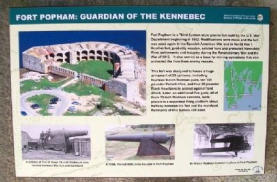
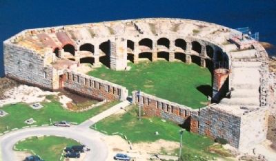
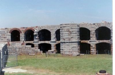
Fort Popham is a Third System style granite fort built by the U.S. War Department beginning in 1862. Modifications were made and the fort was used again in the Spanish American War and in World War 1. Another fort, probably wooden, existed here and protected Kennebec River settlements and industry during the Revolutionary War and the War of 1812. It also served as a base for mining operations that also protected the river from enemy vessels.
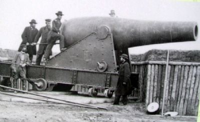
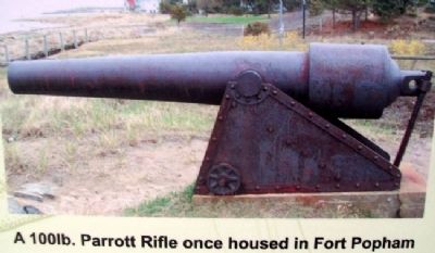
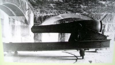
This fort was designed to house a huge armament of 28 cannons, including fourteen 8-inch Rodman guns, ten 100 pounder Parrott rifles, and four 20 pounder Flank Howitzers to protect against land attack. Later, an additional five guns, all of them 15 inch Rodman cannons, were placed in a separated firing platform about halfway between the fort and the mainland. Remnants of this battery still exist.
Erected by Maine Department of Conservation and Popham 400th.
Topics. This historical marker is listed in these topic lists: Forts and Castles • War, US Civil. A significant historical year for this entry is 1862.
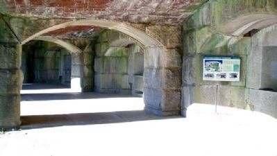
Location. 43° 45.306′ N, 69° 47.001′ W. Marker is in Phippsburg, Maine, in Sagadahoc County. Marker is on a lower casement (gun deck) wall inside Fort Popham State Historic Site, off Popham Road (Maine Route 209). Touch for map. Marker is in this post office area: Phippsburg ME 04562, United States of America. Touch for directions.
Other nearby markers. At least 8 other markers are within 10 miles of this marker, measured as the crow flies. The Casemate Key to a Fort's Design (here, next to this marker); Firing a Cannon (a few steps from this marker); Forts on the Kennebec River (a few steps from this marker); Percival P. Baxter (within shouting distance of this marker); Sites of Forts in this Area (within shouting distance of this marker); Fort Popham State Historic Site (about 700 feet away, measured in a direct line); Phippsburg Veterans and Mariners Memorial (approx. 4.2 miles away); The Caulkers' Shed (1899) (approx. 9.8 miles away). Touch for a list and map of all markers in Phippsburg.
Also see . . .
1. Fort Popham State Historic Site. (Submitted on February 1, 2012, by William Fischer, Jr. of Scranton, Pennsylvania.)
2. Fort Popham, Maine. (Submitted on February 1, 2012, by William Fischer, Jr. of Scranton, Pennsylvania.)
Credits. This page was last revised on September 23, 2020. It was originally submitted on January 31, 2012, by William Fischer, Jr. of Scranton, Pennsylvania. This page has been viewed 1,014 times since then and 28 times this year. Photos: 1, 2, 3, 4, 5, 6. submitted on February 1, 2012, by William Fischer, Jr. of Scranton, Pennsylvania. 7. submitted on January 31, 2012, by William Fischer, Jr. of Scranton, Pennsylvania. 8. submitted on January 31, 2012, by Mike Stroud of Bluffton, South Carolina.
