Sanford in Seminole County, Florida — The American South (South Atlantic)
Fort Reid
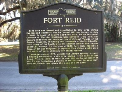
Fort Reid was named and established in this area during the Second Seminole War by Colonel William Harney on July 7, 1840, in honor of Robert Raymond Reid, Fourth Territorial Governor of Florida. Stationed here between July 1840 and January 1841 were the Headquarters of Colonel Twiggs of the Second Dragoons, including the commands of the St. Johns District, Army of the South, plus the District South of New Smyrna under Col. Harney. For the year of 1840, Fort Reid reached a force of 417 and temporarily replaced Fort Mellon a mile and a half north of here, allegedly for health reasons.
Developers about 1875, despite the Army's spelling, created a housing subdivision in this area giving it the name of Fort Reed. Also, in 1886, at what is now the northwest corner of the Airport in Sanford, a station on the railroad between Sanford and Oviedo was given the name of Fort Reed.
Erected by the Seminole County Historical Commission.
Topics. This historical marker is listed in these topic lists: Forts and Castles • Railroads & Streetcars • Wars, US Indian. A significant historical month for this entry is January 1841.
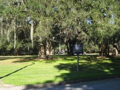
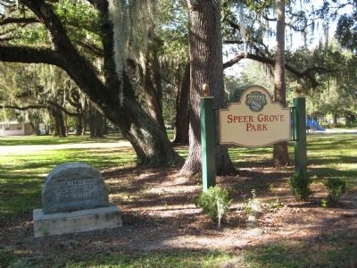
Location. 28° 47.702′ N, 81° 15.381′ W. Marker is in Sanford, Florida, in Seminole County. Marker is on Catalina Drive west of Mellonville Avenue, on the right when traveling west. The marker is located at Speer Grove Park, a Sanford city park. Touch for map. Marker is at or near this postal address: 1830 Mellonville Avenue, Sanford FL 32771, United States of America. Touch for directions.
Other nearby markers. At least 8 other markers are within one mile of this marker, measured as the crow flies. Speer Grove Park (a few steps from this marker); Fort Reid 1836 (approx. ¼ mile away); Hopper Academy (approx. 0.6 miles away); Georgetown (approx. 0.6 miles away); St. James African Methodist Episcopal Church (approx. 0.8 miles away); Dr. Seth French (1824~1896) (approx. one mile away); Historical Figures (approx. 1.1 miles away); Sanford State Farmers' Market (approx. 1.1 miles away). Touch for a list and map of all markers in Sanford.
More about this marker. The marker is capped with the Seminole County Historic Marker logo.
Related markers. Click here for a list of markers that are related to this marker.
Also see . . . Fort Reid. FortWiki website entry (Submitted on October 29, 2021, by Larry Gertner of New York, New York.)
Credits. This page was last revised on October 29, 2021. It was originally submitted on February 3, 2012, by Glenn Sheffield of Tampa, Florida. This page has been viewed 2,053 times since then and 99 times this year. Photos: 1, 2, 3. submitted on February 3, 2012, by Glenn Sheffield of Tampa, Florida. • Craig Swain was the editor who published this page.


