Near Piffard in Livingston County, New York — The American Northeast (Mid-Atlantic)
A-cn-do-wa-nuh
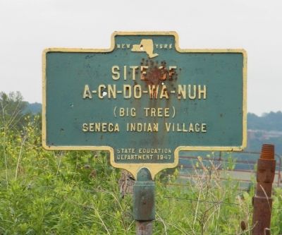
Site of A-cn-do-wa-nuh (Big Tree) Seneca Indian Village
Erected 1947 by New York State Education Department.
Topics. This historical marker is listed in this topic list: Native Americans.
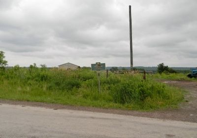
Location. 42° 47.889′ N, 77° 51.709′ W. Marker is near Piffard, New York, in Livingston County. Marker is on River Road (County Road 19) 1.7 miles north of Canandaigua Road, on the right when traveling north. Touch for map. Marker is in this post office area: Piffard NY 14533, United States of America. Touch for directions.
Other nearby markers. At least 8 other markers are within 2 miles of this marker, measured as the crow flies. Boyd – Parker (approx. 1˝ miles away); O-ha-gi (approx. 1˝ miles away); The International Society of Arboriculture and the National Arborist Association (approx. 1˝ miles away); Routes of the Armies (approx. 1˝ miles away); Genesee Castle (approx. 1˝ miles away); Boyd & Parker Park (approx. 1˝ miles away); This wayside shrine marks the place (approx. 1˝ miles away); Cuylerville (approx. 1˝ miles away).
More about this marker. Per the Bulletin - New York State Museum of Natural History, New York State Museum, New York State Museum and Science Service: "Gaundowaneh or Big Tree was a Seneca village on a hill one mile north of Cuylerville. It was on the west side of the river on the farm of EP Slocum in Leicester and was the last town occupied by the Senecas. "
The 100 ft tall Swamp White Oak which marked the location of the Seneca indian village stood on east bank of the Genesee River until it fell into river in 1857. A section of the 27 foot circumstance trunk has been preserved in nearby Geneseo.
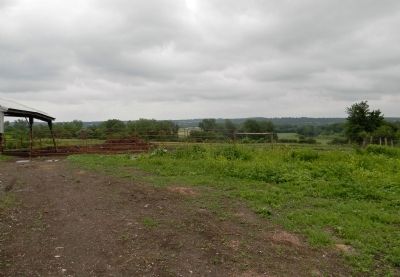
The Treaty of Big Tree conference was held in a meadow on the east bank of the Genesee River, opposite the indian village.
Also see . . . Treaty of Big Tree 1797-1997. Genesee Country Magazine website entry:
Major treaty opened Genesee region to peaceful settlement. (Submitted on February 4, 2012, by PaulwC3 of Northern, Virginia.)
Credits. This page was last revised on February 12, 2022. It was originally submitted on February 4, 2012, by PaulwC3 of Northern, Virginia. This page has been viewed 975 times since then and 43 times this year. Photos: 1, 2, 3. submitted on February 4, 2012, by PaulwC3 of Northern, Virginia.
Editor’s want-list for this marker. Photo of the section of Big Tree trunk on display at the Geneseo Historical Museum • Can you help?


