Westchester Square in the Bronx in Bronx County, New York — The American Northeast (Mid-Atlantic)
St . Peter's Church Westchester
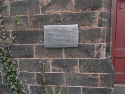
Photographed by Erik Lander, February 4, 2012
1. St. Peter's Church Westchester Marker
The original church on this site was built in 1700 to house a parish organized by an act of the Provincial Assembly in 1693. Queen Anne contributed an altar in 1708. In 1763 a charter was received from King George III. The present church, designed in Gothic style by Leopold Eidlitz was completed in 1853.
Erected 1962.
Topics. This historical marker is listed in these topic lists: Colonial Era • Religion & Religious Structures. A significant historical year for this entry is 1700.
Location. 40° 50.32′ N, 73° 50.648′ W. Marker is in Bronx, New York, in Bronx County. It is in Westchester Square. It is on Westchester Avenue near Saint Peter's Avenue. Touch for map. Marker is at or near this postal address: 2500 Westchester Avenue, Bronx NY 10461, United States of America. Touch for directions.

Regionally, this marker is in New York City. It is also in the American Northeast, in the Mid-Atlantic, and on the Eastern Seaboard. Globally, it is in the North Atlantic Region, North America, the Western Hemisphere, the Western World, and the Anglosphere. Historically, it finds itself in what was once New Netherland
this page online
Other nearby markers. At least 8 other markers are within 2 miles of this marker, measured as the crow flies: World War I Memorial (approx. 0.2 miles away); Historical Marker (approx. 0.2 miles away); Parkchester War Memorial (approx. 0.8 miles away); Hugh J. Grant Circle (approx. 0.9 miles away); FDNY-EMT Yadira Arroyo Playground (approx. one mile away); American Boy (approx. 1.3 miles away); Noble Playground (approx. 1.4 miles away); Ferry Point Park (approx. 1½ miles away). Touch for a list and map of all markers in Bronx.
Another marker is no longer nearby. Chief Dennis L. Devlin Park (was approx. 0.7 miles away but has been confirmed missing).
Also see . . .
1. St. Peter's Church, Chapel and Cemetery Complex. Wikipedia entry (Submitted on February 14, 2021, by Larry Gertner of New York, New York.)
2. St. Peter's Church, Chapel and Cemetery Complex - National Archives. National Register of Historic Places documentation (Submitted on December 19, 2023, by Anton Schwarzmueller of Wilson, New York.)
Credits. This page was last revised on June 15, 2025. It was originally submitted on February 4, 2012, by Erik Lander of Brooklyn, New York. This page has been viewed 1,601 times since then and 95 times this year. Photo 1. submitted on February 4, 2012, by Erik Lander of Brooklyn, New York. • Bill Pfingsten was the editor who published this page.
