Hollidaysburg in Blair County, Pennsylvania — The American Northeast (Mid-Atlantic)
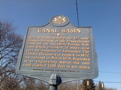
Canal Basin
Erected 1982 by Pennsylvania Historical and Museum Commission.
Topics and series. This historical marker is listed in these topic lists: Railroads & Streetcars • Waterways & Vessels. In addition, it is included in the Pennsylvania Historical and Museum Commission series list. A significant historical month for this entry is March 1834.
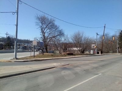
Location. 40° 25.66′ N, 78° 23.796′ W. Marker is in Hollidaysburg, Pennsylvania, in Blair County. Marker is at the intersection of Broad Street (U.S. 22) and South Juniata Street, on the right when traveling west on Broad Street. Located across US 22 from Canal Basin Park. Touch for map. Marker is in this post office area: Hollidaysburg PA 16648, United States of America. Touch for directions.
Other nearby markers. At least 8 other markers are within walking distance of this marker. Jaycee Memorial Park (within shouting distance of this marker); Adam Holliday (approx. 0.2 miles away); First High School (approx. 0.2 miles away); The William Krelitz Building (approx. 0.2 miles away); Daniel Hale Williams (approx. ¼ mile away); Blair County (approx. 0.3 miles away); John Blair (approx. 0.3 miles away); Pioneer Family (approx. 0.3 miles away). Touch for a list and map of all markers in Hollidaysburg.
Also see . . . Canal Basin - Behind the Marker. ExplorePAHistory.com (Submitted on February 6, 2012, by Mike Wintermantel of Pittsburgh, Pennsylvania.)
Credits. This page was last revised on June 16, 2016. It was originally submitted on February 6, 2012, by Mike Wintermantel of Pittsburgh, Pennsylvania. This page has been viewed 855 times since then and 23 times this year. Photos: 1, 2. submitted on February 6, 2012, by Mike Wintermantel of Pittsburgh, Pennsylvania.

