Kent in King County, Washington — The American West (Northwest)
The Saar Pioneer Cemetery
Photographed by Dan McCormick, February 4, 2012
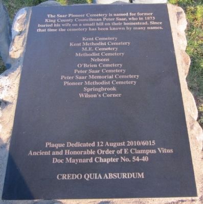
1. The Saar Pioneer Cemetery Marker
The Saar Pioneer Cemetery is named for former King County Councilman Peter Saar, who in 1873 buried his wife on a small hill on their homestead. Since that time the cemetery has been known by many names.
Kent Cemetery • Kent Methodist Cemetery • M.E. Cemetery • Nelsons • O’Brien Cemetery • Peter Saar Cemetery • Peter Saar Memorial Cemetery • Pioneer Methodist Cemetery • Springbrook Wilson’s Corner
Erected 2010 by E Clampus Vitus - Doc Maynard Chapter No. 54-40.
Topics and series. This historical marker is listed in these topic lists: Cemeteries & Burial Sites • Fraternal or Sororal Organizations. In addition, it is included in the E Clampus Vitus series list. A significant historical year for this entry is 1873.
Location. 47° 24.767′ N, 122° 13.15′ W. Marker is in Kent, Washington, in King County. It can be reached from 84th Ave. S. north of South 212th Street, on the right when traveling south. The cemetery is located on the hill in front of the WinCo Grocery Store on the corner of 84th Avenue South and South 212th Street. Touch for map. Marker is in this post office area: Kent WA 98031, United States of America.
this page online

Regionally, this marker is in the Puget Sound Region and in Greater Seattle. It is also on the American Pacific Coast, in the Pacific Northwest, and in the Lewis & Clark Corridor. Globally, it is in North America, in the Cascade Range, in the Inside Passage, on the Ring of Fire, on the Pacific Rim, in the Western Hemisphere, in the Western World, and in the Anglosphere.
Other nearby markers. At least 8 other markers are within 6 miles of this marker, measured as the crow flies: POW/MIA Memorial Plaza (approx. 4.7 miles away); The Freedom Shrine (approx. 4.7 miles away); Barney Clark Memorial Court (approx. 4.7 miles away); Joseph Foster Tree (approx. 5.3 miles away); Foster Landing at Foster Homestead (approx. 5.3 miles away); Salt Water State Park (approx. 5½ miles away); Seike Japanese Garden (approx. 6 miles away); The Victory Garden (approx. 6 miles away).
More about this marker. The marker is just to the right, slightly up the hill as you enter the cemetery.
Photographed by Dan McCormick, February 4, 2012
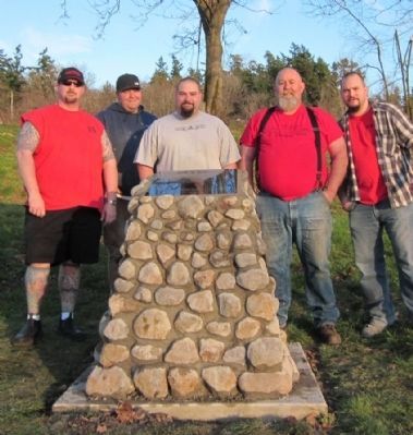
2. The Saar Pioneer Cemetery Marker
Brother's of Doc Maynard Chapter No. 54-40 of The Ancient and Honorable Order of E Clampus Vitus
Photographed by Dan McCormick, February 3, 2012
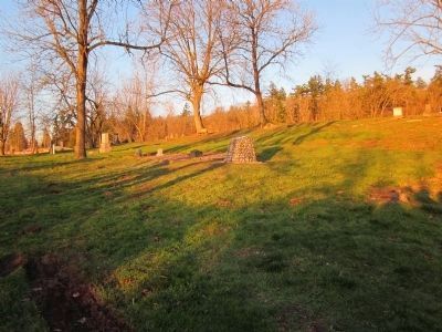
3. The Saar Pioneer Cemetery
View of the marker from the front of the cemetery property.
Credits. This page was last revised on June 16, 2016. It was originally submitted on February 4, 2012, by Dan McCormick of Auburn, Washington. This page has been viewed 4,115 times since then and 139 times this year. Last updated on February 12, 2012, by Dan McCormick of Auburn, Washington. Photos: 1, 2. submitted on February 4, 2012, by Dan McCormick of Auburn, Washington. 3. submitted on February 5, 2012, by Dan McCormick of Auburn, Washington. • Syd Whittle was the editor who published this page.
