Fort Gibson in Muskogee County, Oklahoma — The American South (West South Central)
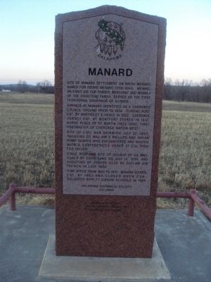
Manard
Springs at Manard identified as a Cherokee council ground prior to 1828. Trading post est. by Bartholet & Heald in 1832. Cherokee agency est. by Montfort Stokes in 1837. Burial place of HT Martin (1822-1868), first postmaster of Cherokee Nation West.
Site of Civil War skirmish on July 27, 1862, involving US Maj. WM A Phillips and Indian Home Guards who encountered and routed Watie's Confederates under Lt Col Thos Fox Taylor.
Stage stop and site of holdup of US Mail by Cook Gang on July 14, 1894, and shooting of Joseph Glad by outlaw Jim French in 1894.
Post office from 1883-1913. Manard school est. by 1863, and closed when consolidated with Ft Gibson Schools in 1966.
Erected 2000 by Oklahoma Historical Society. (Marker Number 237-2000.)
Topics and series. This historical marker is listed in these topic lists: Native Americans • Settlements & Settlers • War, US Civil. In addition, it is included in the Oklahoma Historical Society series list. A significant historical month for this entry is July 1882.
Location. 35° 47.975′ N, 95° 6.27′ W. Marker is in Fort Gibson, Oklahoma, in Muskogee County. Marker is on U.S. 62, half a mile east of South Manard Road, on the right when traveling west. Marker is only accessible from the eastbound lanes of US 62, 1/2 mile east of South Manard Road, approximately 8 miles east of Fort Gibson. Touch for map. Marker is in this post office area: Fort Gibson OK 74434, United States of America. Touch for directions.
Other nearby markers. At least 8 other markers are within 9 miles of this marker, measured as the crow flies. Jack C. Montgomery (approx. 7.4 miles away); Cherokee Warrior Memorial (approx. 7.4 miles away); John Noah Reese, Jr. (approx. 7.4 miles away); Billy B. Walkabout (approx. 7.4 miles away); Seventh United States Infantry (approx. 8.4 miles away); Park Hill (approx. 8.4 miles away); Riley's Chapel (approx. 8.4 miles away); Park Hill Press (approx. 8.4 miles away).
Credits. This page was last revised on June 16, 2016. It was originally submitted on February 13, 2012, by Michael Manning of Woodlawn, Tennessee. This page has been viewed 1,139 times since then and 71 times this year. Photo 1. submitted on February 13, 2012, by Michael Manning of Woodlawn, Tennessee. • Craig Swain was the editor who published this page.
Editor’s want-list for this marker. A photo of the marker and the surrounding area in context. • Can you help?
