Near Farmington in San Juan County, New Mexico — The American Mountains (Southwest)
Bisti Wilderness
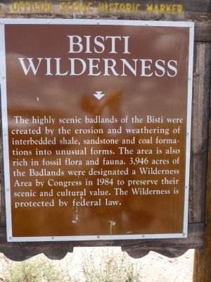
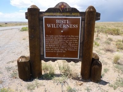
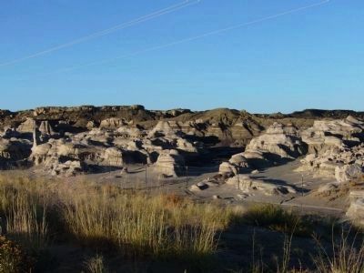
The highly scenic badlands of the Bisti were created by the erosion and weathering of interbedded shale, sandstone and coal formations into unusual forms. The area is also rich in fossil flora and fauna. 3,946 acres of the Badlands were designated a Wilderness Area by Congress in 1984 to preserve their scenic and cultural value. The Wilderness is protected by federal law.
Erected by New Mexico Historic Preservation Division and Department of Highways.
Topics. This historical marker is listed in this topic list: Environment. A significant historical year for this entry is 1984.
Location. 36° 19.53′ N, 108° 15.369′ W. Marker is near Farmington, New Mexico, in San Juan County. Marker is at the intersection of State Road 371 at milepost 77, and County Road 7250, on the right when traveling south on State Road 371. Touch for map. Marker is in this post office area: Farmington NM 87401, United States of America. Touch for directions.
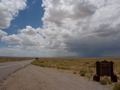
More about this marker. Although an agriculture/hunting BIA service and hydrocarbon service line branches east at the Bisti Wilderness sign, a sign at the turnoff says, "No Bisti Wilderness Access." The adventurer would be best served by County Road 7500 from the east or south of this sign and turnoff.
Regarding Bisti Wilderness. Bisti means "dirt clod" in Navajo.
From "Discover Navajo" dot com:
Step back into history - say, 65 million years back - and get a feel for the ancient Navajoland vistas at Bisti Badlands Wilderness Area. The peculiar soft clay formations are spread over a vast moon-like valley, and some of the domes can literally erode before your eyes during the rainstorms of Navajoland summers. Within these opaque ridges of bizarre geologic beauty are scientific tales about the demise of dinosaurs and the ascent of mammals.
There are no signposts pointing the way to the Badlands from any nearby towns, but the usual approach route is along NM 371 from Farmington, the largest town in the Four Corners region - this heads due south through wide open prairie land at the east edge of the great Navajo Indian Reservation, which extends for 200 miles across into Arizona. After 36 miles, a gravel track exits east, opposite an historical marker recording the history of this area and of the nearby Bisti trading post, now derelict.
Also see . . .
1. The Bisi Badlands Wilderness. Information and photos of the area. (Submitted on July 13, 2010.)
2. Bisti Wilderness Area. Detailed information on the area accompanied with photos. (Submitted on July 13, 2010.)
Additional keywords. Navajo Nation
Photographed By Thomas Chris English, July 2, 2010
3. Bisti Wilderness Marker - Lonely Planet Guidebook Shot
N.M. 371 headed south to Spencer's Bisti Food Stand and Crown Point, Navajo Nation, New Mexico. At the left edge of the photo one can magnify the road 7250 sign and on the west shoulder the formal - "No Bisti Wilderness Access" sign at the turn off. Decision to travel is 'twixt you and our Creator.
Photographed By Thomas Chris English, July 2, 2010
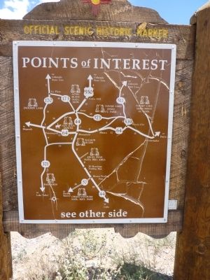
4. Bisti Wilderness Marker - Reverse
New Mexico Historic Marker Maps
The state's Official Scenic Historic Markers usually have a map on the reverse side showing the location of more local markers. For the ardent historical marker seeker, these maps are mines of information, waiting for extraction.
Credits. This page was last revised on February 7, 2024. It was originally submitted on July 10, 2010, by Chris English of Phoenix, Arizona. This page has been viewed 1,612 times since then and 15 times this year. Last updated on February 17, 2012. Photos: 1, 2, 3, 4. submitted on July 10, 2010, by Chris English of Phoenix, Arizona. 5. submitted on October 3, 2010, by Bill Kirchner of Tucson, Arizona. • Syd Whittle was the editor who published this page.
