Bayonne in Hudson County, New Jersey — The American Northeast (Mid-Atlantic)
Port Jersey Peninsula Preserve
Photographed by Bill Coughlin, February 27, 2012
1. Port Jersey Peninsula Preserve Marker
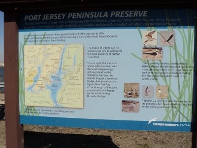
The Port Authority of New York & New Jersey has established preserved areas within the Port Jersey Peninsula to protect and maintain fragile wetlands and wildlife, and provide a waterfront which can be enjoyed by all.
From here you can see some of the greatest landmarks this area has to offer. If you stand facing Manhattan, you will be enjoying a view of the World Financial Center, and beyond it, the Empire State Building.
The Statue of Liberty can be seen to your left, as well as the red brick buildings of historic Ellis Island.
To your right, the shores of Staten Island connect with the southwestern edge of Long Island via the Verrazano-Narrows, the world’s longest suspension bridge. And directly across Upper New York Bay is the borough of Brooklyn, connected to Manhattan by the world-famous Brooklyn Bridge.
These wetlands feature a unique tidal habitat shared by both land and open ocean areas. They are home to rich vegetation, as well as several species of birds, including the Black Skimmer, which nests in its sandy shores.
A special 2.2-acre parcel at the east end of the peninsula has been set aside specifically the endangered
this page online
Erected by The Port Authority of NY & NJ.
Topics. This historical marker is listed in this topic list: Natural Features.
Location. 40° 40.255′ N, 74° 4.191′ W. Marker is in Bayonne, New Jersey, in Hudson County. It is on Port Jersey Blvd., on the left when traveling east. Touch for map. Marker is in this post office area: Bayonne NJ 07002, United States of America. Touch for directions.

Regionally, this marker is in North Jersey, in Greater Newark, and in the New York City Metropolitan Area. It is also in the American Northeast, in the Mid-Atlantic, and on the Eastern Seaboard. Globally, it is in the North Atlantic Region, North America, the Western Hemisphere, the Western World, and the Anglosphere. Historically, it finds itself in what was once New Netherland and also one of the original Thirteen Colonies.
Other nearby markers. At least 8 other markers are within 2 miles of this marker, measured as the crow flies: Tear of Grief (approx. half a mile away); Monument to the Struggle Against World Terrorism (approx. half a mile away); Bayonne Terrorist Victims
Photographed by Bill Coughlin, February 27, 2012
2. Port Jersey Peninsula Preserve Marker
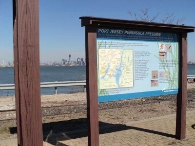
Lower Manhattan can be seen behind the marker.
Other markers no longer nearby. Morris Pesin’s Legendary Canoe Trip Which Launched Liberty State Park (was approx. 1.6 miles away but has been confirmed missing); Explosion at Liberty! (was approx. 1.6 miles away but has been confirmed missing).
More about this marker. Photos of various species of aquatic birds appear on the right side of the marker. A map of the Upper New York Bay area appears on the left of the marker. In addition to the location of the marker, the map also indicates the locations of the Statue of Liberty, Ellis Island, Governors Island, World Trade Center site, Empire State Building, and other landmarks.
Photographed by Bill Coughlin, February 27, 2012
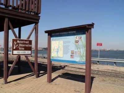
3. Marker on the Port Jersey Peninsula
Photographed by Bill Coughlin, February 27, 2012
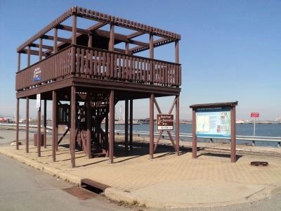
4. Marker and Waterfront Observation Platform
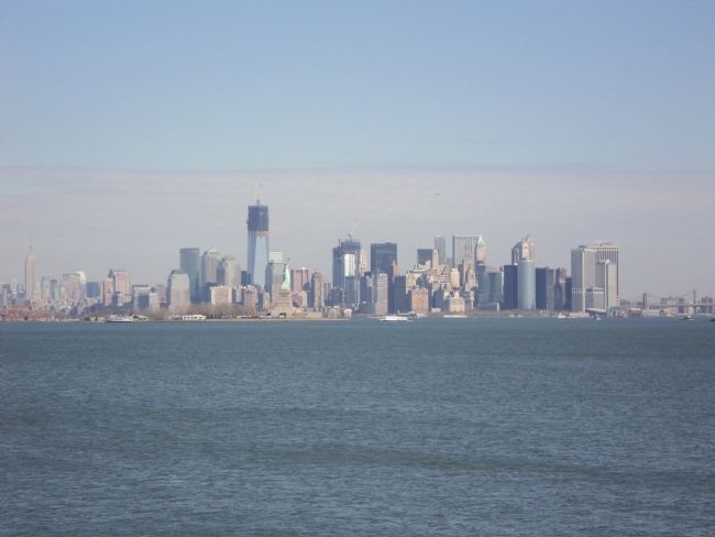
Photographed by Bill Coughlin, February 27, 2012
5. View from the Waterfront Observation Platform
Lower Manhattan can be seen from the observation deck. Some of the sights visible in the photo include Ellis Island and the Empire State Building (far left), the Statue of Liberty and unfinished Freedom Tower (center) and the Manhattan and Brooklyn Bridges (far right).
Credits. This page was last revised on June 16, 2016. It was originally submitted on February 28, 2012, by Bill Coughlin of Woodland Park, New Jersey. This page has been viewed 858 times since then and 35 times this year. Photos: 1, 2, 3, 4, 5. submitted on February 28, 2012, by Bill Coughlin of Woodland Park, New Jersey.
