Cherryvale in Montgomery County, Kansas — The American Midwest (Upper Plains)
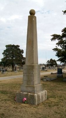
Cherryvale War Memorial
Photographed by William Fischer, Jr., December 18, 2011
1. Cherryvale War Memorial
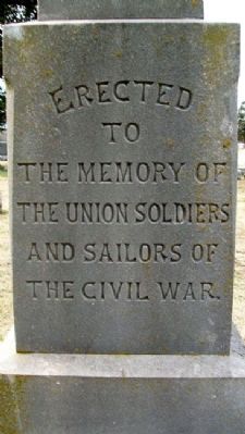
Union Soldiers and Sailors
of the Civil War
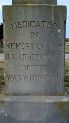
Dedicated in memory of the
U.S. Armed Forces
of the War with Spain
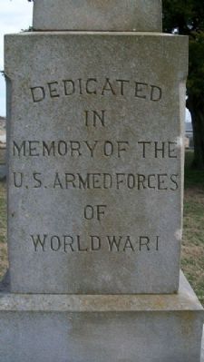
Dedicated in memory of the
U.S. Armed Forces of
World War I
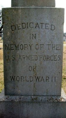
Dedicated in memory of the
U.S. Armed Forces of
World War II
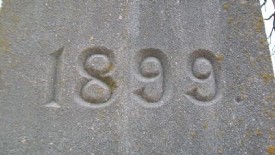
Erected 1899.
Topics. This historical marker and memorial is listed in these topic lists: War, Spanish-American • War, US Civil • War, World I • War, World II.
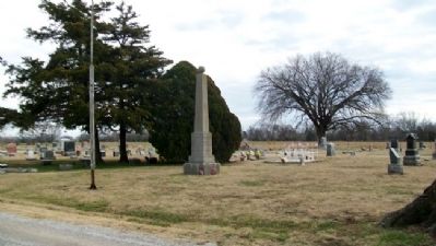
Location. 37° 16.339′ N, 95° 32.116′ W. Marker is in Cherryvale, Kansas, in Montgomery County. It can be reached from Montgomery County Road 5700. Monument is in Fairview Cemetery, off 5700th Road/Olive Street, on the northeast side of town. Touch for map. Marker is in this post office area: Cherryvale KS 67335, United States of America. Touch for directions.

Regionally, this marker and memorial is in Eastern Kansas. It is also in the American Midwest, in the Corn Belt, on the prairies, and on the Southern Plains. Globally, it is in North America, the Western Hemisphere, the Western World, and the Anglosphere. Historically, it finds itself in what was once New Spain and also the Louisiana Purchase.
Other nearby markers. At least 8 other markers are within 10 miles of this marker, measured as the crow flies: Carnegie Free Library (approx. ¾ mile away); Frank E. Bellamy (approx. 1.2 miles away); Veterans Memorial (approx. 1.2 miles away); Drum Creek and the Civil War (approx. 8.2 miles away); Dewlen - Spohnhauer Memorial Bridge (approx. 8.6 miles away); United Spanish War Veterans Memorial (approx. 9.4 miles away); First Organized Night Baseball Game (approx. 9½ miles away); F-100F Super Sabre (approx. 9½ miles away). Touch for a list and map of all markers in Cherryvale.
Another marker is no
this page online
Photographed by William Fischer, Jr., December 18, 2011
2. Cherryvale War Memorial
Photographed by William Fischer, Jr., December 18, 2011
3. Cherryvale War Memorial
Photographed by William Fischer, Jr., December 18, 2011
4. Cherryvale War Memorial
Photographed by William Fischer, Jr., December 18, 2011
5. Cherryvale War Memorial
Photographed by William Fischer, Jr., December 18, 2011
6. Cherryvale War Memorial
Photographed by William Fischer, Jr., December 18, 2011
7. Cherryvale War Memorial
Credits. This page was last revised on February 13, 2026. It was originally submitted on February 28, 2012, by William Fischer, Jr. of Reynoldsburg, Ohio. This page has been viewed 899 times since then and 26 times this year. Photos: 1, 2, 3, 4, 5, 6, 7. submitted on February 28, 2012, by William Fischer, Jr. of Reynoldsburg, Ohio.
