Martinez in Contra Costa County, California — The American West (Pacific Coastal)
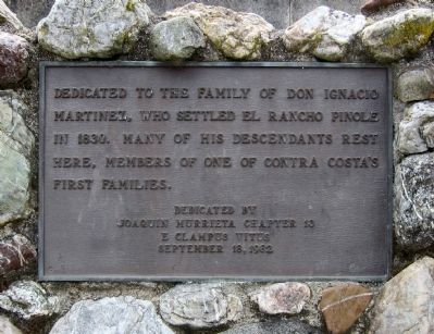
Dedicated to the Family of Don Ignacio Martinez
Photographed by Andrew Ruppenstein, February 26, 2012
1. Dedicated to the Family of Don Ignacio Martinez Marker
Erected 1982 by E Clampus Vitus, Joaquin Murrieta Chapter 13.
Topics and series. This historical marker is listed in these topic lists: Cemeteries & Burial Sites • Hispanic Americans • Settlements & Settlers. In addition, it is included in the E Clampus Vitus series list. A significant historical month for this entry is September 1825.
Location. 38° 1.047′ N, 122° 8.704′ W. Marker is in Martinez, California, in Contra Costa County. It is on Carquinez Scenic Drive 0.1 miles west of Talbart Street. The marker is located just footsteps away from the entrance of St. Catherine of Siena's Cemetery (which is almost immediately across the street from the entrance to the Alhambra Cemetery.) Note, also, that Carquinez Scenic Road is also known as Snake Road. Touch for map. Marker is in this post office area: Martinez CA 94553, United States of America. Touch for directions.

Regionally, this marker is in the San Francisco Bay Area and on the Coast Ranges. It
this page online
Other nearby markers. At least 8 other markers are within walking distance of this marker: Pioneer Cemetery (within shouting distance of this marker); Captain Joseph R. Walker (within shouting distance of this marker); James Rankin (within shouting distance of this marker); Hook Family (about 300 feet away, measured in a direct line); Capt. Joseph R. Walker (about 500 feet away); God's Acre (about 600 feet away); a different marker also named James Rankin (about 700 feet away); Former Anti-Aircraft W.W. II Barracks (approx. 0.2 miles away). Touch for a list and map of all markers in Martinez.
Photographed by Andrew Ruppenstein, February 26, 2012
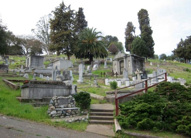
2. Dedicated to the Family of Don Ignacio Martinez Marker - wide view
The marker is visible here mounted to the stone bench/monument to the immediate left of the steps. There is a smaller plaque next to the marker reading "Anna's Bench".
Credits. This page was last revised on August 3, 2023. It was originally submitted on February 29, 2012, by Andrew Ruppenstein of Lamorinda, California. This page has been viewed 2,246 times since then and 61 times this year. Photos: 1, 2. submitted on February 29, 2012, by Andrew Ruppenstein of Lamorinda, California. • Syd Whittle was the editor who published this page.
