Lenox in Cook County, Georgia — The American South (South Atlantic)
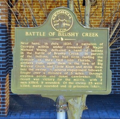
Battle of Brushy Creek
Erected 1958 by Georgia Historical Commission. (Marker Number 037-4.)
Topics and series. This historical marker is listed in this topic list: Wars, US Indian. In addition, it is included in the Georgia Historical Society series list. A significant historical month for this entry is July 1836.
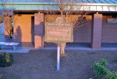
Location. 31° 14.604′ N, 83° 27.921′ W. Marker is in Lenox, Georgia, in Cook County. Marker is at the intersection of Interstate 75 at milepost 46 and (Northbound) Rest Area #5, on the right when traveling north on Interstate 75. The marker is located in front of the Rest Area building, reached from the northbound lanes of I-75. Touch for map. Marker is in this post office area: Lenox GA 31637, United States of America. Touch for directions.
Other nearby markers. At least 8 other markers are within 8 miles of this marker, measured as the crow flies. Reed Bingham State Park Bridge (approx. 7.3 miles away); Cook County Veterans Memorial (approx. 7.6 miles away); Cook County (approx. 7.6 miles away); Cook County Tornado of 2017 (approx. 7.6 miles away); Cook County Courthouse (approx. 7.6 miles away); Old United States Post Office, Adel, Georgia (approx. 7.8 miles away); Adel Lime Sink (approx. 7.8 miles away); SOWEGA Building (approx. 7.8 miles away).
Credits. This page was last revised on June 16, 2016. It was originally submitted on March 1, 2012, by David Seibert of Sandy Springs, Georgia. This page has been viewed 1,291 times since then and 45 times this year. Photos: 1, 2, 3. submitted on March 1, 2012, by David Seibert of Sandy Springs, Georgia. • Craig Swain was the editor who published this page.


