Ashburn in Turner County, Georgia — The American South (South Atlantic)
Turner County
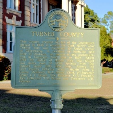
Photographed by David Seibert, January 15, 2012
1. Turner County Marker
Erected 1954 by Georgia Historical Commission. (Marker Number 142-1.)
Topics and series. This historical marker is listed in these topic lists: Government & Politics • War, US Civil • Wars, US Indian. In addition, it is included in the Georgia Historical Society series list. A significant historical year for this entry is 1905.
Location. 31° 42.461′ N, 83° 39.175′ W. Marker is in Ashburn, Georgia, in Turner County. It is at the intersection of East College Avenue and McLendon Street, on the left when traveling east on East College Avenue.
this page online

Regionally, this marker is on Georgia’s Coastal Plain. It is also in the American South and specifically in the Deep South. Globally, it is in North America, the Western Hemisphere, the Western World, and the Anglosphere. Historically, it finds itself in what was once the territory of the Mississippian Culture, one of the original Thirteen Colonies, one of the Confederate States of America, and the Antebellum South.
Other nearby markers. At least 2 other markers are within 17 miles of this marker, measured as the crow flies: Historic Downtown Sylvester (approx. 16.3 miles away); Worth County (approx. 16½ miles away).
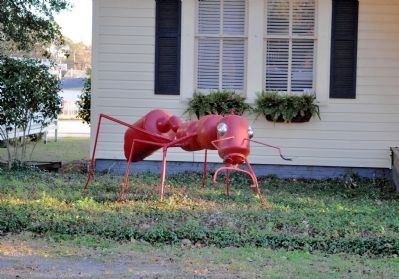
Regarding Turner County. Turner County is known as "The Peanut Capital of the World; Ashburn is home of "The Fireant Festival."
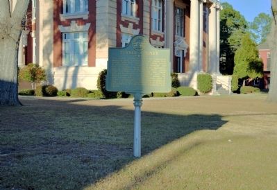
Photographed by David Seibert, January 15, 2012
2. Turner County Marker
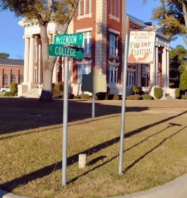
Photographed by David Seibert, January 15, 2012
3. Turner County Marker
The marker, US Coast & Geodetic Survey Marker, and a sign for Ashburn's "Fire Ant Festival" stand in front of the Turner County Courthouse.
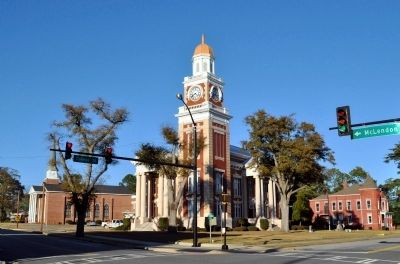
Photographed by David Seibert, January 15, 2012
4. Turner County Marker and Courthouse
Turner County's only courthouse was built in 1907.
Photographed by David Seibert, January 15, 2012
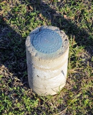
5. U.S. Coast & Geodetic Survey Marker
The marker, placed in 1934, stands on the courthouse lawn. The town of Ashburn is approximately 1690 feet above mean sea level.
Photographed by David Seibert, January 15, 2012
6. "The Big Fire Ant"
In front of the Turner County Chamber of Commerce

Photographed by David Seibert, January 15, 2012
7. The Old Turner County Jail
The old jail is now the "Crime and Punishment Museum" with the "Last Meal Cafe."
Photographed by Wikipedia
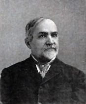
8. Captain Henry Gray Turner
For whom Turner County was named
Credits. This page was last revised on October 21, 2020. It was originally submitted on March 5, 2012, by David Seibert of Sandy Springs, Georgia. This page has been viewed 4,602 times since then and 166 times this year. Photos: 1, 2, 3, 4, 5, 6, 7, 8. submitted on March 5, 2012, by David Seibert of Sandy Springs, Georgia. • Craig Swain was the editor who published this page.
