Near Pittsburg in Crawford County, Kansas — The American Midwest (Upper Plains)
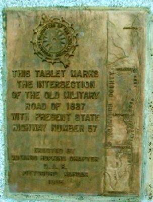
The Old Military Road of 1837
Erected 1936 by Oceanic Hopkins Chapter, Daughters of the American Revolution.
Topics and series. This historical marker is listed in this topic list: Roads & Vehicles. In addition, it is included in the Daughters of the American Revolution series list. A significant historical year for this entry is 1837.
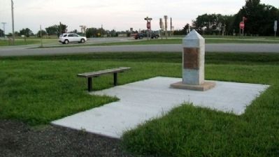
Location. 37° 20.343′ N, 94° 42.296′ W. Marker is near Pittsburg, Kansas, in Crawford County. Marker is at the intersection of Bypass U.S. 69 and State Highway 171, on the right when traveling north on U.S. 69Bypass . Marker is accessed off Langdon Lane/220th Street. Touch for map. Marker is in this post office area: Pittsburg KS 66762, United States of America. Touch for directions.
Other nearby markers. At least 8 other markers are within 4 miles of this marker, measured as the crow flies. Crocker Cemetery Veterans Memorial (approx. 1.8 miles away); Veterans Memorial (approx. 3.1 miles away); Pittsburg State University Veteran's Amphitheater (approx. 3.6 miles away); Chandler Hall (approx. 3.6 miles away); Kansas State Teachers College Navy Mark of Commendation (approx. 3.6 miles away); Carney Hall (approx. 3.6 miles away); Pittsburg State University Gymnasium (approx. 3.7 miles away); G.A.R.-W.R.C. Civil War Memorial (approx. 3.8 miles away). Touch for a list and map of all markers in Pittsburg.
More about this marker. The marker was moved to its present location by the Kansas Department of Transportation after it had been vandalized and roadway rerouting necessitated its removal from its original location.
Also see . . .
1. The Fort Leavenworth - Fort Gibson Military Road (1942 article). (Submitted on March 7, 2012, by William Fischer, Jr. of Scranton, Pennsylvania.)
2. Frontier Military Historic Byway. (Submitted on March 7, 2012, by William Fischer, Jr. of Scranton, Pennsylvania.)
Credits. This page was last revised on September 1, 2020. It was originally submitted on March 7, 2012, by William Fischer, Jr. of Scranton, Pennsylvania. This page has been viewed 711 times since then and 16 times this year. Photos: 1, 2. submitted on March 7, 2012, by William Fischer, Jr. of Scranton, Pennsylvania.

