Near Cameiro in Ellsworth County, Kansas — The American Midwest (Upper Plains)
Mushroom Rock State Park
Photographed by William Fischer, Jr., September 5, 2011
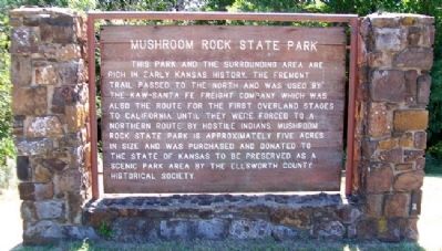
1. Mushroom Rock State Park Marker
This park and the surrounding area are rich in early Kansas history. The Fremont Trail passed to the north and was used by the Kaw-Santa Fe Freight Company which was also the route for the first overland stages to California until they were forced to a northern route by hostile Indians. Mushroom Rock State Park is approximately five acres in size and was purchased and donated to the State of Kansas to be preserved as a scenic park area by the Ellsworth County Historical Society.
Erected by Kansas Department of Wildlife, Parks and Tourism.
Topics. This historical marker is listed in this topic list: Natural Features.
Location. 38° 43.546′ N, 98° 1.824′ W. Marker is near Cameiro, Kansas, in Ellsworth County. It is on K Street near 25th Road, on the right when traveling east. Touch for map. Marker is in this post office area: Marquette KS 67464, United States of America. Touch for directions.

Regionally, this marker is in the Smoky Hills. It is also in the American Midwest, in the Corn Belt, on the prairies, and on the Southern Plains. Globally, it is in North
this page online
Other nearby markers. At least 8 other markers are within 11 miles of this marker, measured as the crow flies: Smoky Hills Region (approx. 10.3 miles away); Historic Kansas (approx. 10.7 miles away); 1873 County Jail (approx. 10.7 miles away); The Plaza (1873) (approx. 10.8 miles away); Grand Central Hotel (approx. 10.8 miles away); Kansas Pacific Railroad Depots (approx. 10.8 miles away); Joe Brennan Saloon (approx. 10.8 miles away); Nick Lentz Saloon (approx. 10.9 miles away).
Also see . . .
1. Mushroom Rock State Park, Kansas. Legends of Kansas website entry (Submitted on December 4, 2024, by Larry Gertner of New York, New York.)
2. Ellsworth County, Kansas, Geologic Map. Kansas Geological Survey website entry (Submitted on March 12, 2012, by William Fischer, Jr. of Reynoldsburg, Ohio.)
Photographed by William Fischer, Jr., September 5, 2011
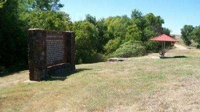
2. Mushroom Rock State Park Marker
Photographed by William Fischer, Jr., September 5, 2011
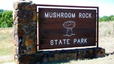
3. Mushroom Rock State Park Sign
Photographed by William Fischer, Jr., September 5, 2011
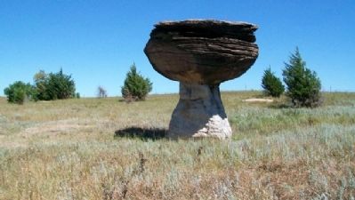
4. Concretion at Mushroom Rock State Park
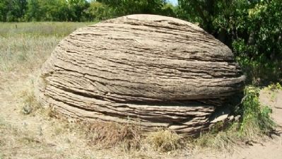
Photographed by William Fischer, Jr., September 5, 2011
5. Concretion at Mushroom Rock State Park
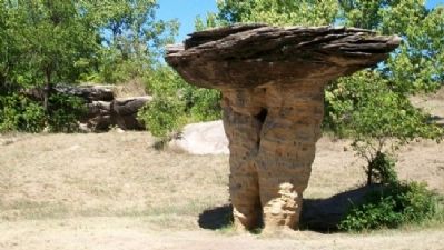
Photographed by William Fischer, Jr., September 5, 2011
6. Concretion at Mushroom Rock State Park
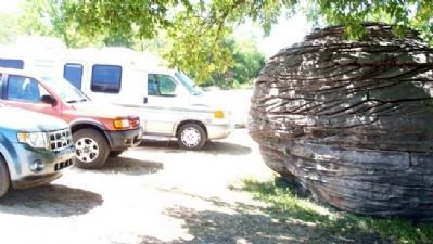
Photographed by William Fischer, Jr., September 5, 2011
7. Mushroom Rock State Park Parking Area
Credits. This page was last revised on December 4, 2024. It was originally submitted on March 12, 2012, by William Fischer, Jr. of Reynoldsburg, Ohio. This page has been viewed 973 times since then and 26 times this year. Photos: 1, 2, 3, 4, 5, 6. submitted on March 12, 2012, by William Fischer, Jr. of Reynoldsburg, Ohio. 7. submitted on March 13, 2012, by William Fischer, Jr. of Reynoldsburg, Ohio.
