Fredericksburg, Virginia — The American South (Mid-Atlantic)
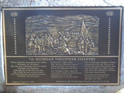
7th Michigan Volunteer Infantry
Photographed by Kevin W., February 2, 2008
1. 7th Michigan Volunteer Infantry Marker
“Dark rolled the Rappahannock’s flood,
Michigan, my Michigan;
The tide was crimsoned with thy blood,
Michigan, my Michigan;
Although for us the day was lost,
Yet it shall be our proudest boast,
At Fredericksburg our Seventh crossed,
Michigan, my Michigan.”
In December 1862, Union Gen. Ambrose Burnside ordered pontoon bridges to be thrown across the Rappahannock River.
Col. Norman J. Hall, asked for volunteers to flush out Confederate riflemen by crossing the Rappahannock in pontoon boats.
The 7th Michigan Volunteer Infantry responded to his call. The men of the Seventh poled and paddled their way across the river. Once ashore, they drove the Confederate riflemen from their concealments.
The battle of Fredericksburg occurred two days later on December 13, 1862.
Dedicated August 31, 2003 Sponsored by the 7th Michigan Volunteer Infantry, Co. B, Inc.
Erected 2003 by 7th Michigan Volunteer Infantry, Co. B, Inc.
Topics. This historical marker is listed in this topic list: War, US Civil. A significant historical month for this entry is December 1862.
Location. 38° 18.461′ N,
this page online

Regionally, this marker is in the Washington Metropolitan Area and in Northern Virginia. It is also in the American South and specifically in the Upper South. Globally, it is in North America, the Western Hemisphere, the Western World, and the Anglosphere. Historically, it finds itself in what was once the territory of the Mississippian Culture, one of the original Thirteen Colonies, one of the Confederate States of America, and the Antebellum South.
Other nearby markers. At least 8 other markers are within walking distance of this marker: Pontoon Bridge Site (here, next to this marker); Fredericksburg Campaign (here, next to this marker); 1856 (about 300 feet away, measured in a direct line); 1883 (about 300 feet away); 1868 (about 400 feet away); Rising Sun Tavern (about 400 feet away); a different marker also named Rising Sun Tavern (about 400
Photographed by Bill Coughlin, November 9, 2007
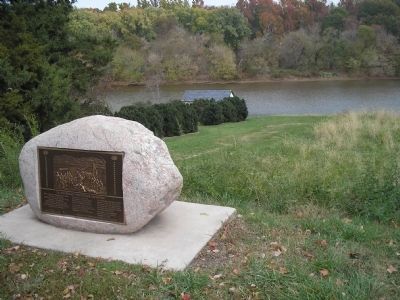
2. 7th Michigan Volunteer Infantry Marker
The site of the upper pontoon bridge over the Rappahannock River can be seen behind the marker.
Another marker is no longer nearby. Fredericksburg Campaign, December 1862 (was about 600 feet away but has been replaced with another marker now near it).
Also see . . . 7th Michigan Infantry. All Michigan Civil War website entry (Submitted on August 23, 2025, by Larry Gertner of New York, New York.)
Additional commentary.
1. Michigan, My Michigan
The verses quoted on this marker are the eighth stanza of the 1862 version of the song “Michigan, My Michigan” written by William Otto Miessner and sung to the tune “Oh, Tannenbaum.” (It appears that by 1886 that stanza was no longer printed on sheet music for this song, and that Douglas S Malloch rewrote it for the current version in 1902.)
— Submitted January 10, 2009, by J. J. Prats of Powell, Ohio.
Photographed by Kevin W., February 2, 2008
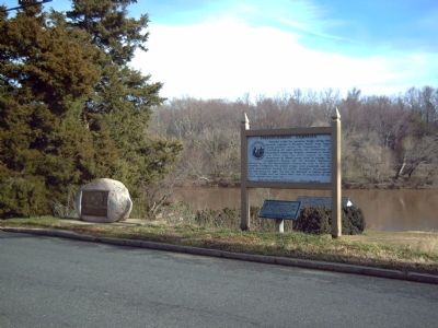
3. 7th Michigan Volunteer Infantry Marker
Credits. This page was last revised on August 23, 2025. It was originally submitted on February 13, 2008, by Kevin W. of Stafford, Virginia. This page has been viewed 2,116 times since then and 51 times this year. Photos: 1. submitted on February 13, 2008, by Kevin W. of Stafford, Virginia. 2. submitted on May 5, 2011, by Bill Coughlin of Woodland Park, New Jersey. 3. submitted on February 13, 2008, by Kevin W. of Stafford, Virginia.
