Rockport in Aransas County, Texas — The American South (West South Central)
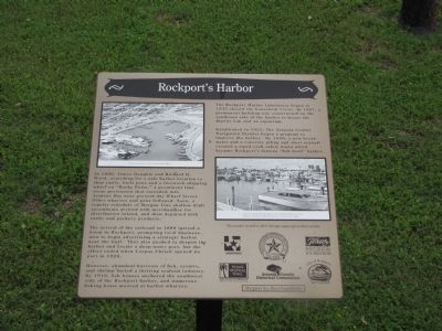
Rockport’s Harbor
The arrival of the railroad in 1888 ignited a boom in Rockport, prompting local businessmen to begin advertising a strategic harbor near the Gulf. They also pushed to deepen the harbor and create a deep-water port, but the effort ended when Corpus Christi opened its port in 1926.
However, abundant harvests of fish, oysters, and shrimp fueled a thriving seafood industry. By 1910, fish houses anchored the southwest side of the Rockport harbor, and numerous fishing boats moored at harbor wharves.
The Rockport Marine Laboratory began in 1935 aboard the houseboat Vivian. In 1947, a permanent building was constructed on the southeast side of the harbor to house the Marine Lab and an aquarium.
Established in 1925, The Aransas County Navigation District began a program to improve the harbor. By 1940, a new breakwater and a concrete piling and steel seawall created a small-craft safety basin which became Rockport’s famous “fish bowl” harbor.
Erected 2011 by Visionaries in Preservation, Aransas County Historical Society, Inc., Texas Historical Foundation, Texas Tropical Trail/Texas Historical Commission, Aransas county Historical Commission, City of Rockport, and Margaret Sue Rust Foundation. (Marker Number 8.)
Topics. This historical marker is listed in these topic lists: Industry & Commerce • Waterways & Vessels. A significant historical year for this entry is 1866.
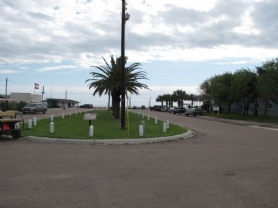
Location. 28° 1.568′ N, 97° 2.87′ W. Marker is in Rockport, Texas, in Aransas County. Marker is on Veterans Memorial Drive, 0.1 miles east of Chamber Street, in the median. Touch for map. Marker is at or near this postal address: Veterans Memorial Drive, Rockport TX 78382, United States of America. Touch for directions.
Other nearby markers. At least 8 other markers are within walking distance of this marker. The Big Blue Crab (about 600 feet away, measured in a direct line); Rockport Marine Laboratory (about 600 feet away); Hoopes-Smith House (about 700 feet away); Woman’s Club of Aransas County Building (about 700 feet away); Fulton-Bruhl House (about 700 feet away); Jackson Family Maritime Companies (about 700 feet away); Rockport’s Seafood Industry (about 800 feet away); First National Bank of Rockport (about 800 feet away). Touch for a list and map of all markers in Rockport.
Credits. This page was last revised on June 16, 2016. It was originally submitted on March 21, 2012. This page has been viewed 834 times since then and 10 times this year. Last updated on March 22, 2012. Photos: 1, 2, 3, 4. submitted on March 21, 2012. • Bernard Fisher was the editor who published this page.


