Near Moncks Corner in Berkeley County, South Carolina — The American South (South Atlantic)
Wadboo Barony: Francis Marion’s Last Headquarters
Inscription.
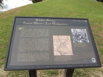
Wadboo was a Native American name given to the enormous landholding of James Colleton, a son of Sir John Colleton, who was one of the original eight Lords Proprietors of the Carolina colony. Called a barony according to the Proprietors’ plan for an American nobility, Wadboo remained in the hands of James Colleton’s descendants from the original land grant in 1683 until after the Revolutionary War.
On August 29, 1782, a British foraging party, made up of white and black troops and commanded by Maj. Thomas Fraser, attacked Brig. Gen. Francis Marion and his militiamen at Wadboo, where they had camped the night before. Arranging his Brigade around the main house and slave quarters and along a lane of large cedar trees (across the creek from here), Marion beat back the British attack. During the engagement, Maj. Micajah Ganey, a former Tory who had recently come over to the Whig side in a treaty at Burch’s Mill, fought heroically with Marion.
From shortly after the skirmish until the British abandoned South Carolina in December, Francis Marion made Wadboo his headquarters. Here on December 15, 1782, the day after the British evacuation of Charleston, Marion dismissed his Brigade and made for his own ruined plantation of Pond Bluff.
Erected 2012 by Francis Marion Trail Commission of Francis Marion University.
Topics and series. This historical marker is listed in these topic lists: Colonial Era • War, US Revolutionary. In addition, it is included in the Francis Marion Trail series list. A significant historical year for this entry is 1683.
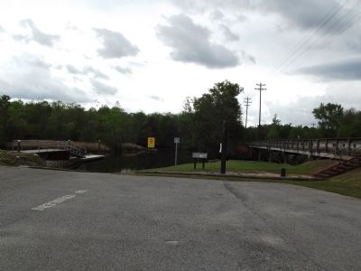
Location. 33° 11.753′ N, 79° 57.193′ W. Marker is near Moncks Corner, South Carolina, in Berkeley County. Marker can be reached from State Highway 402 just north of State Highway S-8-44, on the left when traveling west. Marker is at a boat landing. Touch for map. Marker is in this post office area: Moncks Corner SC 29461, United States of America. Touch for directions.
Other nearby markers. At least 8 other markers are within 2 miles of this marker, measured as the crow flies. Wadboo Barony (a few steps from this marker); Stony Landing House (approx. one mile away); Too Formidable to Take (approx. 1.1 miles away); Colleton House: “Unmanly Practices” or Legitimate Target? (approx. 1.1 miles away); Fort Fair Lawn: An Archeaological Treasure (approx. 1.1 miles away); C.S.S. David (approx. 1.1 miles away); Berkeley County Museum and Heritage Center: A County's Story (approx. 1.1 miles away); Berkeley County Confederate Monument (approx. 1.1 miles away). Touch for a list and map of all markers in Moncks Corner.

Photographed By Anna Inbody, March 24, 2012
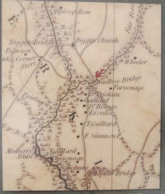
3. Map on the marker
The location of Wadboo Barony, from Mills‘ Atlas (1825). For most of the 18th century, the owners of Wadboo Barony lived elsewhere, while enslaved Africans and their descendants produced indigo, rice, and timber. After the war the land was sold under the Confiscation Act, which sought to punish South Carolina Loyalists.

Photographed By Anna Inbody, March 24, 2012
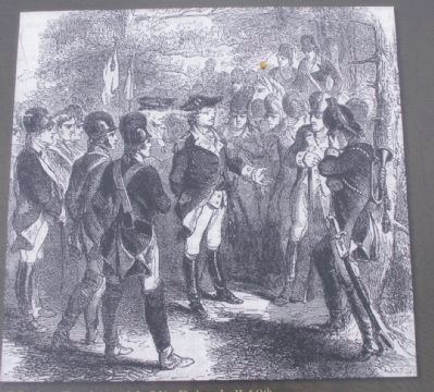
4. Picture on the marker
“Marion Parting with His Brigade,” 19th - century engraving. In 2007 and 2008, archaeological investigation at Wadboo identified the likely locations of the main house, the battlefield, and the slave quarters where Marion’s men made their last encampment.Courtesy Harper‘s Magazine.
Credits. This page was last revised on June 16, 2016. It was originally submitted on March 25, 2012, by Anna Inbody of Columbia, South Carolina. This page has been viewed 2,843 times since then and 163 times this year. Photos: 1, 2, 3, 4. submitted on March 25, 2012, by Anna Inbody of Columbia, South Carolina. • Bill Pfingsten was the editor who published this page.

