Near Spotsylvania Courthouse in Spotsylvania County, Virginia — The American South (Mid-Atlantic)
Flank Attack!
The Battle of the Wilderness
| — | Fredericksburg and Spotsylvania National Military Park | — |
Photographed by Bill Coughlin, November 10, 2007
1. Flank Attack! Marker
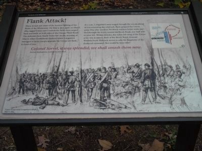
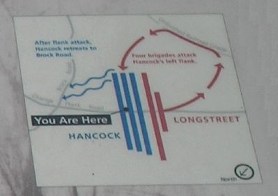
This marker describes the flank attack made by the troops of Confederate Lt. Gen. James Longstreet against those of Union Maj. Gen. Winfield Scott Hancock during the Battle of the Wilderness on May 6, 1864.
These woods saw some of the heaviest fighting of the Battle of the Wilderness. On May 5, then again on May 6, 1864 ragged Union and Confederate battle lines surged back and forth on both sides of the Orange Plank Road. The stalemate here finally broke late on the morning of May 6, when Confederate General James Longstreet managed to move troops opposite the Union left flank, in front of you.
At 11 a.m., Longstreet’s men surged through the woods ahead of you screaming the rebel yell. Panic gripped the Union army. One after another, Northern soldiers broke ranks and fled through the brush toward the Brock Road, one-half mile to your left. Within minutes, the entire left wing of the Union army was in tatters. Back at the Brock Road, General Winfield Scott Hancock strove to rally the fragments of his shattered command. But would he have time?
Colonel Sorrel, it was splendid; we shall smash them now.
General Micah Jenkins, Confederate staff officer
Erected by National Park Service, U.S. Department of the Interior.
Topics. This historical marker is listed in this topic list: War, US Civil. A significant historical month for this entry is May 1862.
Location. 38° 17.877′ N,
this page online

Regionally, this marker is in the Washington Metropolitan Area, in Northern Virginia, and in the Piedmont. It is also in the American South, specifically in the Upper South, in the Mid-Atlantic, and on the Eastern Seaboard. Globally, it is in the North Atlantic Region, North America, the Western Hemisphere, the Western World, and the Anglosphere. Historically, it finds itself in what was once the territory of the Mississippian Culture, one of the original Thirteen
Photographed by Bill Coughlin, November 10, 2007
2. A set of three markers
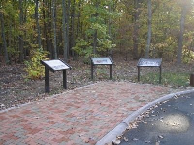
Flank Attack! is one of three markers at this location along the auto tour road of the Wilderness Battlefield.
Other nearby markers. At least 8 other markers are within walking distance of this marker: Longstreet Felled (here, next to this marker); Burying the Dead (here, next to this marker); James S. Wadsworth (approx. ¼ mile away); The Vermont Brigade (approx. 0.3 miles away); Hell Itself (approx. 0.3 miles away); Horror on the Orange Plank Road (approx. 0.3 miles away); Valuable Crossroads (approx. 0.3 miles away); Echoes Homeward (approx. 0.3 miles away). Touch for a list and map of all markers in Spotsylvania Courthouse.
More about this marker. The background of the marker is a drawing titled Union troops resist Longstreet's attack, May 6, 1864.
Photographed by Bill Coughlin, November 10, 2007
3. Battle Map of Longstreet's flank attack
Credits. This page was last revised on July 9, 2021. It was originally submitted on February 14, 2008, by Bill Coughlin of Woodland Park, New Jersey. This page has been viewed 1,804 times since then and 33 times this year. Photos: 1, 2, 3. submitted on February 14, 2008, by Bill Coughlin of Woodland Park, New Jersey. • Craig Swain was the editor who published this page.
