Big Bend National Park in Brewster County, Texas — The American South (West South Central)
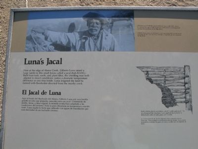
Luna's Jacal
(photo)
Gilberto Luna built this jacal and lived here until 1947, when he died at the age of 108. Luna was well-known and respected among the residents of the Big Bend.
(drawing)
Jacal construction is sometimes called “wattle and daub.” To weatherproof the structure, Luna applied mud plaster to latticework walls of cane grass and ocotillo.
Español
El Jacal de Luna
Aquí al bordo de Alamo Creek, Gilberto Luna crió una familia grande en esta casa pequeña conocida como un jacal. Construida de piedra, tierra, y fibra vegetal, la morada estaba bien adaptada a las condiciones del desierto. Note la gran diferencia de temperatura cuando entre. Luna regaba la tierra que cultivaba con aguas de inundación que eran desviadas de un riachuelo cercano.
(foto)
Gilberto Luna construyó este jacal y vivió aquí hasta 1947, cuando murió a la edad de 108. Luna fue muy conocido y respetado entre los residentes de Big Bend.
(dibujo)
La construcción de un jacal es algunas veces conocido como el bajareque. Para proteger la construcción del mal tiempo, Luna cubrió las paredes enrejadas de grama de caña y ocotillo con un emplasto de barro.
Topics and series. This historical marker is listed in these topic lists: Hispanic Americans • Settlements & Settlers. In addition, it is included in the Comanche Trail into Mexico series list. A significant historical year for this entry is 1947.
Location. 29° 12.936′ N, 103° 32.091′ W. Marker is in Big Bend National Park, Texas, in Brewster County. Marker is on Old Maverick Road, 6½ miles south of Maverick Drive (Texas Highway 118), on the left when traveling south. Touch for map. Marker is in this post office area: Big Bend National Park TX 79834, United States of America. Touch for directions.
Other nearby markers. At least 8 other markers are within 6 miles of this marker, measured as the crow flies. Terlingua Abaja (approx. 4.3 miles away); Grand Canyon Farms (approx. 5 miles away); La Harmonia Store (approx. 5.3 miles away); Into the Canyon! (approx. 5.7 miles away); Floodplain Panorama (approx. 5.7 miles away); Cavalry Post to Trading Post (approx. 5.8 miles away); Garlick House (approx. 5.8 miles away); Magdalena's House (approx. 5.8 miles away). Touch for a list and map of all markers in Big Bend National Park.
Also see . . . Luna's Jacal. Wikipedia (Submitted on March 27, 2012, by Richard Denney of Austin, Texas.)

Photographed By Richard Denney, March 23, 2012
3. Alamo Wash and the Comanche Trail
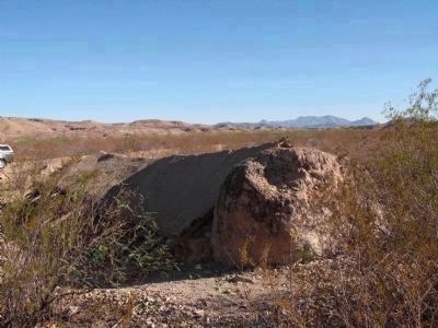
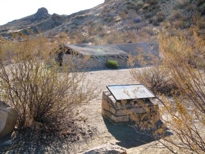
A view from the rear of Luna's Jacal out onto Alamo Wash. As noted in the write-up for the National Register of Historic Places, Alamo Wash was on the Comanche War Trail through the park. A story recounted in the NRHP write-up relates how Luna through diplomacy survived the "incursions of these raiding Indians", though an interview with a grandson of Luna, Demencio C. Luna Jr., put Luna's arrival at Alamo Wash after the close of the Comanche Trail (Exploring The Big Bend Country, Koch and Price).
Note how the Jacal incorporates a boulder as the rear wall of the Jacal.
Credits. This page was last revised on August 27, 2020. It was originally submitted on March 27, 2012, by Richard Denney of Austin, Texas. This page has been viewed 1,847 times since then and 74 times this year. Photos: 1, 2. submitted on March 27, 2012, by Richard Denney of Austin, Texas. 3. submitted on May 14, 2014, by Richard Denney of Austin, Texas. • Bernard Fisher was the editor who published this page.

