Marker Logo HMdb.org THE HISTORICAL
MARKER DATABASE
“Bite-Size Bits of Local, National, and Global History”
Big Bend National Park in Brewster County, Texas — The American South (West South Central)
 

Terlingua Abaja


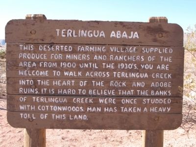
Terlingua Abaja Marker image. Click for full size.
Photographed By Richard Denney, March 23, 2012
1. Terlingua Abaja Marker
Inscription. This deserted farming village supplied produce for miners and ranchers of the area from 1900 until the 1930's. You are welcome to walk across Terlingua Creek into the heart of the rock and adobe ruins. It is hard to believe that the banks of Terlingua Creek were once studded with cottonwoods. Man has taken a heavy toll of this land.
 
Topics. This historical marker is listed in these topic lists: EnvironmentHispanic AmericansSettlements & Settlers. A significant historical year for this entry is 1900.
 
Location. 29° 11.88′ N, 103° 36.212′ W. Marker is in Big Bend National Park, Texas, in Brewster County. Marker is on Gaging Station, 1˝ miles west of Old Maverick Road. Marker is located in a side road parking area. Backcountry roadside campsites are located here as well (permit required). Touch for map. Marker is in this post office area: Terlingua TX 79852, United States of America. Touch for directions.
 
Other nearby markers. At least 8 other markers are within 7 miles of this marker, measured as the crow flies. Into the Canyon! (approx. 2.2 miles away); Grand Canyon Farms (approx. 3.3 miles away); Luna's Jacal (approx. 4.3 miles away); La Harmonia Store (approx. 6.3 miles away); Floodplain Panorama (approx. 6.9 miles away); Cavalry Post to Trading Post (approx. 6.9 miles away); Garlick House
Paid Advertisement
Click on the ad for more information.
Please report objectionable advertising to the Editor.
Click or scan to see
this page online
(approx. 6.9 miles away); Magdalena's House (approx. 7 miles away). Touch for a list and map of all markers in Big Bend National Park.
 
Also see . . .  Handbook of Texas Online. Terlingua Abaja was originally named simply "Terlingua" and later renamed to Terlingua Abaja when the current town of Terlingua, TX was established. (Submitted on March 28, 2012, by Richard Denney of Austin, Texas.) 
 
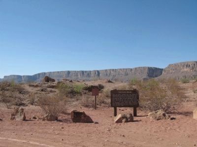
Terlingua Abaja Marker, View in context image. Click for full size.
Photographed By Richard Denney, March 23, 2012
2. Terlingua Abaja Marker, View in context
Santa Elena Canyon of the Rio Grande can be seen in the background.
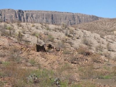
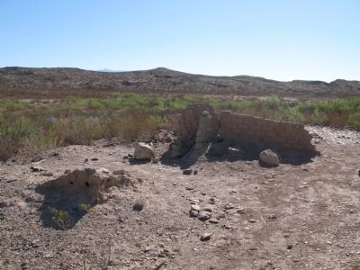
Sample stacked rock ruins image. Click for full size.
Photographed By Richard Denney, March 23, 2012
3. Sample stacked rock ruins
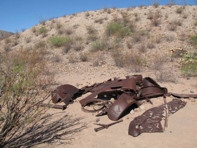
Remains of old truck image. Click for full size.
Photographed By Richard Denney, March 23, 2012
4. Remains of old truck
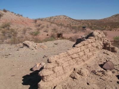
Sample of adobe ruins image. Click for full size.
Photographed By Richard Denney, March 23, 2012
5. Sample of adobe ruins
History marker can be seen beyond ruins.
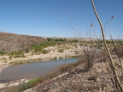
Cottonwoods image. Click for full size.
Photographed By Richard Denney, March 23, 2012
6. Cottonwoods
Up the creek a short distance a few remaining cottonwoods provide an idea of what the area once looked like before trees were cleared for farming and to support mining activities.
Sample of adobe ruins image. Click for full size.
Photographed By Richard Denney, March 23, 2012
7. Sample of adobe ruins
 
 
Credits. This page was last revised on June 16, 2016. It was originally submitted on March 28, 2012, by Richard Denney of Austin, Texas. This page has been viewed 994 times since then and 32 times this year. Photos:   1, 2, 3, 4, 5, 6, 7. submitted on March 28, 2012, by Richard Denney of Austin, Texas. • Bernard Fisher was the editor who published this page.
Share this page.  
Share on Tumblr
m=53958

CeraNet Cloud Computing sponsors the Historical Marker Database.
This website earns income from purchases you make after using our links to Amazon.com. We appreciate your support.
Paid Advertisement
Apr. 26, 2024