Main/Military Plaza in San Antonio in Bexar County, Texas — The American South (West South Central)
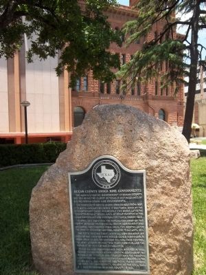
Bexar County Under Nine Governments
The administrative government of Bexar County, besides being the oldest in Texas, is distinguished by having served under nine governments.
The community served under Spanish rule from May, 1718, until January, 1811, when it was taken over by the revolutionary Casas regime. Only five weeks later, the counter-revolutionary Junta of Bexar overthrew the Casas government and eventually restored Spanish rule.
In April, 1812, however, the Republican Army of the North deposed the provincial Spanish government and declared independence from Spain. Five months later the Spanish regained control, holding Texas until 1821.
The fifth regime, First Imperial Government of Mexico was created when Mexico gained independence from Spain in 1821. The emperor relinquished control to army leaders within two years, however, and the Republic of Mexico was established.
Texas gained independence from Mexico in 1836, thereby establishing Bexar's seventh government, the Republic of Texas. In 1845, Texas became the twenty-eighth state of the United States and remained in the Union until 1861, when the southern states seceded to form the Confederacy. Following the Civil War, U.S. rule returned to Bexar County in 1865.
Erected 1967 by State Historical Survey Committee. (Marker Number 400.)
Topics. This historical marker is listed in these topic lists: Hispanic Americans • Settlements & Settlers • War, Texas Independence • War, US Civil. A significant historical year for this entry is 1718.
Location. Marker has been reported missing. It was located near 29° 25.354′ N, 98° 29.63′ W. Marker was in San Antonio, Texas, in Bexar County. It was in Main/Military Plaza. Marker was at the intersection of East Nueva Street and South Main Avenue, on the right when traveling west on East Nueva Street. Touch for map. Marker was in this post office area: San Antonio TX 78205, United States of America. Touch for directions.
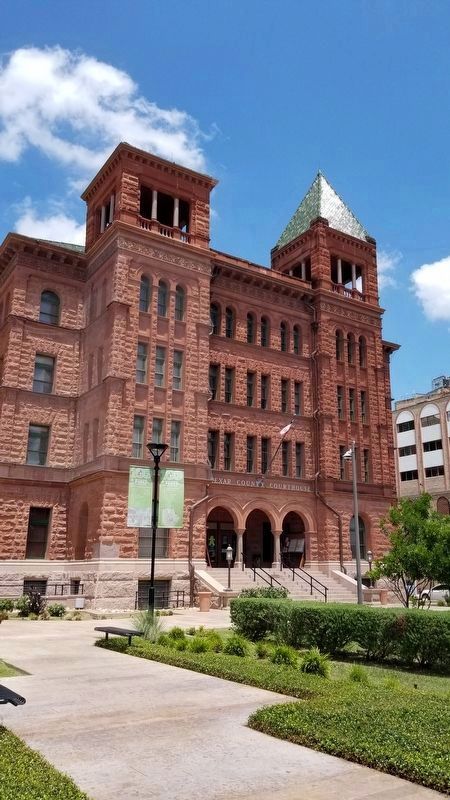
Other nearby markers. At least 8 other markers are within walking distance of this location. Near Homesite of Erasmo Seguin (a few steps from this marker); Justitia (within shouting distance of this marker); The Bexar County Courthouse (about 400 feet away, measured in a direct line); American Legion Memorial Highway (about 500 feet away); San Antonio Mutual Aid Association (about 500 feet away); "Save the Plaza" (about 500 feet away); 200th Anniversary of San Antonio Municipal Government (about 500 feet away); Lasting Peace with the Apache Nation (about 500 feet away). Touch for a list and map of all markers in San Antonio.
Credits. This page was last revised on February 2, 2023. It was originally submitted on March 29, 2012, by Zacharias Beau T of Alpine, Texas. This page has been viewed 874 times since then and 17 times this year. Photos: 1. submitted on March 29, 2012, by Zacharias Beau T of Alpine, Texas. 2. submitted on August 10, 2021, by James Hulse of Medina, Texas. • Craig Swain was the editor who published this page.
Editor’s want-list for this marker. A clear, close-up photo of the marker. • A wide view photo of the marker and the surrounding area in context. • Can you help?

