Cupertino in Santa Clara County, California — The American West (Pacific Coastal)
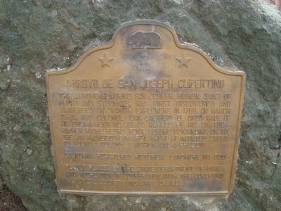
Arroyo de San Joseph Cupertino
Erected 1968 by State Department of Parks and Recreation in cooperation with the Cupertino Historical Society Inc. (Marker Number 800.)
Topics and series. This historical marker is listed in these topic lists: Exploration • Hispanic Americans. In addition, it is included in the California Historical Landmarks, and the Juan Bautista de Anza National Historic Trail series lists. A significant historical month for this entry is March 1897.
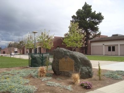
Location. 37° 18.927′ N, 122° 3.46′ W. Marker is in Cupertino, California, in Santa Clara County. Marker is on McClellan Road east of Bryne Road, on the right when traveling east. This marker is located near the entrance to the Monte Vista High School student parking lot. Touch for map. Marker is at or near this postal address: 2184 McClellan Road, Cupertino CA 95014, United States of America. Touch for directions.
Other nearby markers. At least 8 other markers are within 3 miles of this marker, measured as the crow flies. Captain Elisha Stephens (approx. half a mile away); Stevens Creek Dam & Reservoir (approx. 1.6 miles away); St. Joseph’s College (approx. 2.2 miles away); The First Home on the Ranch (approx. 2.3 miles away); Everyday Life at the Ranch (approx. 2.3 miles away); Winery and Ranch Operations (approx. 2.3 miles away); Picchetti Ranch (approx. 2.4 miles away); Collins-Scott Winery (approx. 2.4 miles away). Touch for a list and map of all markers in Cupertino.
Also see . . . Cupetinio: History. Cupertino owes its earliest mention in recorded history to the 1776 expedition led by the Spanish explorer, Captain Juan Bautista de Anza. Starting in Sonora, Mexico, De Anza led a group up the coast of California aiming to establish a presidio (fort) on San Francisco Bay. (Submitted on March 31, 2012, by Barry Swackhamer of Brentwood, California.)
Credits. This page was last revised on June 16, 2016. It was originally submitted on March 31, 2012, by Barry Swackhamer of Brentwood, California. This page has been viewed 1,469 times since then and 76 times this year. Photos: 1, 2. submitted on March 31, 2012, by Barry Swackhamer of Brentwood, California. • Syd Whittle was the editor who published this page.

