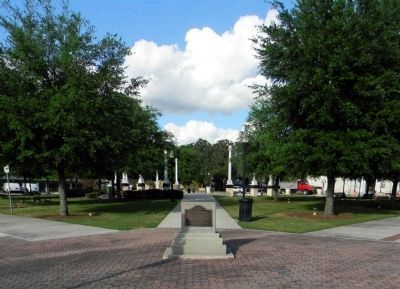
Bartow in Polk County, Florida — The American South (South Atlantic)
Site of Fort Blount
for the settlers of this community
during the Seminole Indian War 1855-1858
Name changed to Bartow 1867
In honor of Confederate General
Francis S. Bartow
Erected 1947 by Bartow Chapter of the Daughters of the American Revolution.
Topics and series. This historical marker is listed in these topic lists: Forts and Castles • Settlements & Settlers • Wars, US Indian. In addition, it is included in the Daughters of the American Revolution series list. A significant historical year for this entry is 1853.
Location. 27° 53.793′ N, 81° 50.641′ W. Marker is in Bartow, Florida, in Polk County. Marker is at the intersection of West Main Street and North Carpenter Avenue on West Main Street. The marker is located at the southwest corner of Fort Blount Park. Touch for map. Marker is in this post office area: Bartow FL 33830, United States of America. Touch for directions.
Other nearby markers. At least 8 other markers are within 3 miles of this marker, measured as the crow flies. Old Polk County Courthouse (about 400 feet away, measured in a direct line); Mann Manor (about 500 feet away); Swearingen - Langford House (approx. 0.4 miles away); Historic L. B. Brown House (approx. 0.6 miles away); Evergreen & Palm Cemeteries (approx. 0.7 miles away); Union Academy High School (approx. 1.4 miles away); Memorial for Austin C. Welch (approx. 1.7 miles away); Fort Carroll (approx. 2.7 miles away). Touch for a list and map of all markers in Bartow.
More about this marker. The marker was originally located one block to the west near the intersection of South Floral Avenue and West Main Street. This was the approximate location of Fort Blount, which was a single blockhouse.
Regarding Site of Fort Blount. Redding Blount and some 21 people including family, other settlers and slaves arrived at what is now Bartow, in October 1851. A settler blockhouse was built for community protection by Redding Blount. The community was named Fort Blount after the fort but was later renamed Pease Creek until it was named Bartow in 1867. The blockhouse was probably abandoned as a fortification before the end of the Third Seminole War in 1858. Also known as Redding Blount's Fort.
Credits. This page was last revised on March 11, 2017. It was originally submitted on April 2, 2012, by PaulwC3 of Northern, Virginia. This page has been viewed 1,932 times since then and 88 times this year. Last updated on April 2, 2012, by Glenn Sheffield of Tampa, Florida. Photos: 1, 2. submitted on April 2, 2012, by PaulwC3 of Northern, Virginia. • Craig Swain was the editor who published this page.

