Los Gatos in Santa Clara County, California — The American West (Pacific Coastal)
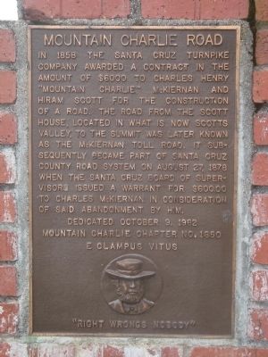
Mountain Charlie Road
Erected 1982 by E Clampus Vitus, Mountain Charlie Chapter No. 1850.
Topics and series. This historical marker is listed in this topic list: Roads & Vehicles. In addition, it is included in the E Clampus Vitus series list. A significant historical year for this entry is 1858.
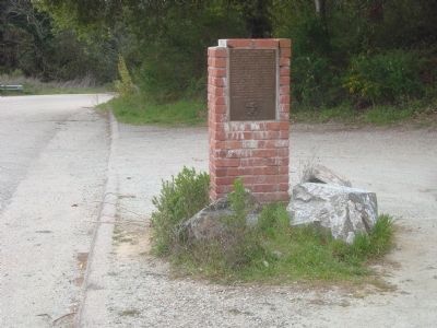
Location. 37° 8.649′ N, 121° 59.125′ W. Marker is in Los Gatos, California, in Santa Clara County. Marker is on Mountain Charlie Road just south of Summit Road, on the right when traveling south. Touch for map. Marker is at or near this postal address: 17955 Mountain Charlie Road, Los Gatos CA 95033, United States of America. Touch for directions.
Other nearby markers. At least 8 other markers are within 3 miles of this marker, measured as the crow flies. Mountain Charlies Cabin (approx. half a mile away); Patchen (approx. 0.7 miles away); Mountain Charlie Bear Fight (approx. 1.2 miles away); Chateau Liberté (approx. 1.2 miles away); Mountain Charlie Big Tree (approx. 1.9 miles away); Charles Martin Winery (approx. 2½ miles away); Glenwood (approx. 2½ miles away); Alma College Library Foundation (approx. 2.8 miles away). Touch for a list and map of all markers in Los Gatos.
Credits. This page was last revised on June 16, 2016. It was originally submitted on March 13, 2012, by Barry Swackhamer of Brentwood, California. This page has been viewed 1,038 times since then and 170 times this year. Last updated on April 5, 2012, by Barry Swackhamer of Brentwood, California. Photos: 1, 2. submitted on March 13, 2012, by Barry Swackhamer of Brentwood, California. • Syd Whittle was the editor who published this page.

