
Near Bar Harbor in Hancock County, Maine — The American Northeast (New England)
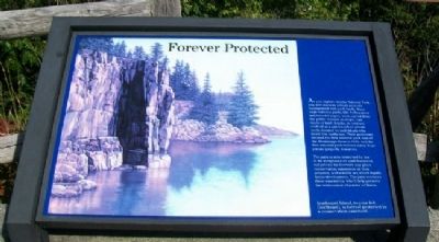
Forever Protected
Photographed by William Fischer, Jr., September 21, 2011
1. Forever Protected Marker
As you explore Acadia National Park, you will discover private property interspersed with park lands. Many large national parks, like Yellowstone and Grand Canyon, were carved from the public domain as single, vast tracts of land. Acadia, in contrast, evolved as a patchwork of private lands donated by individuals who loved this landscape. Their generosity created the first national park east of the Mississippi River in 1916, and the first national park derived solely from private property donations.
The park is now restricted by law in its acceptance of land donations, but private landowners may place conservation easements on their property, a charitable act which legally limits development. The park oversees these easements, which help preserve the wild coastal character of Maine.
[Background photo caption reads]
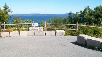
Ironbound Island, to your left (northeast) is forever protected by a conservation easement.
Erected by National Park Service.
Topics. This historical marker is listed in this topic list: Natural Features. A significant historical year for this entry is 1916.
Location. 44° 20.386′ N, 68° 10.642′ W. Marker
this page online

Regionally, this marker is on Mount Desert Island and in Downeast Maine. It is also in the American Northeast, in New England, and on the Eastern Seaboard. Globally, it is in the North Atlantic Region, North America, the Great North Woods, the Western Hemisphere, the Western World, and the Anglosphere. Historically, it finds itself in what was once the Viceroyalty of New France and also Acadia.
Other nearby markers. At least 8 other markers are within 2 miles of this marker, measured as the crow flies: Secrets of the Sand (approx. 0.8 miles away); Unusual Pocket Beach (approx. 0.8 miles away); Sand Beach (approx. 0.8 miles away); Satterlee Field (approx. 0.8 miles away); Peregrine Falcons Return to Acadia (approx. 0.9 miles away); What Do Park Rangers Do? (approx. 1.4 miles away); Icy Depths (approx.
Photographed by William Fischer, Jr., September 21, 2011
2. Forever Protected Marker
Also see . . . Acadia National Park. (Submitted on April 14, 2012, by William Fischer, Jr. of Reynoldsburg, Ohio.)
Credits. This page was last revised on June 16, 2016. It was originally submitted on April 14, 2012, by William Fischer, Jr. of Reynoldsburg, Ohio. This page has been viewed 755 times since then and 15 times this year. Photos: 1, 2. submitted on April 14, 2012, by William Fischer, Jr. of Reynoldsburg, Ohio.
