Tyreeanna in Lynchburg, Virginia — The American South (Mid-Atlantic)
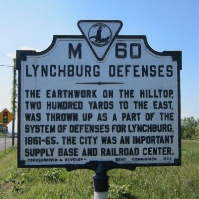
Lynchburg Defenses
Erected 1929 by Conservation & Development Commission. (Marker Number M-60.)
Topics and series. This historical marker is listed in this topic list: War, US Civil. In addition, it is included in the Virginia Department of Historic Resources (DHR) series list.
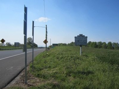
Location. 37° 22.652′ N, 79° 7.73′ W. Marker is in Lynchburg, Virginia. It is in Tyreeanna. Marker is at the intersection of Campbell Avenue (U.S. 501) and Richmond Highway (U.S. 460), on the right when traveling north on Campbell Avenue. Touch for map. Marker is in this post office area: Lynchburg VA 24501, United States of America. Touch for directions.
Other nearby markers. At least 8 other markers are within 2 miles of this marker, measured as the crow flies. Chestnut Hill (approx. 0.4 miles away); Virginia Collegiate and Industrial Institute (approx. 1.2 miles away); Desmond Thomas Doss (approx. 1.4 miles away); Megginson Rosenwald School (approx. 1.7 miles away); Ota Benga (approx. 1.7 miles away); Virginia University of Lynchburg (approx. 1.7 miles away); John Chilembwe (approx. 1.7 miles away); Gregory Willis Hayes (approx. 1.8 miles away). Touch for a list and map of all markers in Lynchburg.
Credits. This page was last revised on February 1, 2023. It was originally submitted on April 14, 2012, by Bernard Fisher of Richmond, Virginia. This page has been viewed 703 times since then and 25 times this year. Photos: 1, 2. submitted on April 14, 2012, by Bernard Fisher of Richmond, Virginia.

