Woodland in Lynchburg, Virginia — The American South (Mid-Atlantic)
Defense Works
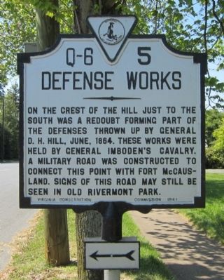
Photographed by Bernard Fisher, April 12, 2012
1. Defense Works Marker
Erected 1941 by Virginia Conservation Commission. (Marker Number Q-6-5.)
Topics and series. This historical marker is listed in this topic list: War, US Civil. In addition, it is included in the Virginia Department of Historic Resources (DHR) series list. A significant historical month for this entry is June 1864.
Location. 37° 26.342′ N, 79° 10.885′ W. Marker is in Lynchburg, Virginia. It is in Woodland. It is at the intersection of Rivermont Avenue and Langhorne Road, on the right when traveling west on Rivermont Avenue. Touch for map. Marker is in this post office area: Lynchburg VA 24503, United States of America. Touch for directions.

Regionally, this marker is in Central Virginia. It is also in the American South and specifically in the Upper South. Globally, it is in North America, the Western Hemisphere,
this page online
Other nearby markers. At least 8 other markers are within walking distance of this marker: Sallie Blount Mahood (1864-1953) (approx. 0.3 miles away); Helen McGehee (approx. 0.3 miles away); Randolph-Macon Woman's College (approx. half a mile away); Morris Stanley Alexander (1891-1977) (approx. half a mile away); Main Hall (approx. half a mile away); Pearl S. Buck (approx. 0.6 miles away); The Fernando Wood Martin Science Building (approx. 0.6 miles away); Safe Haven in Lynchburg: Project Y (approx. 0.8 miles away). Touch for a list and map of all markers in Lynchburg.
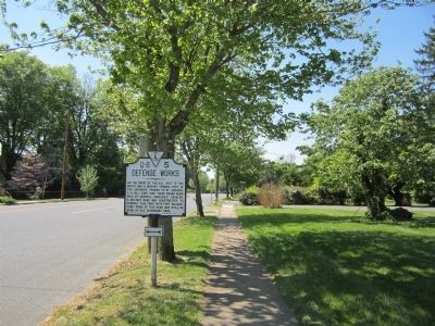
Photographed by Bernard Fisher, April 12, 2012
2. Rivermont Ave (facing west)
Credits. This page was last revised on February 1, 2023. It was originally submitted on April 14, 2012, by Bernard Fisher of Richmond, Virginia. This page has been viewed 953 times since then and 27 times this year. Photos: 1, 2. submitted on April 14, 2012, by Bernard Fisher of Richmond, Virginia.
