
Near Sharpsburg in Washington County, Maryland — The American Northeast (Mid-Atlantic)
D.H. Hill's Division, Jackson's Command
Photographed by Craig Swain, August 5, 2007
1. D.H. Hill's Division, Jackson's Command Marker
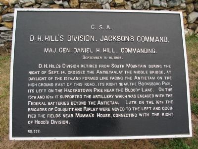
D.H. Hill's Division, Jackson's Command,
Maj. Gen. Daniel H. Hill, commanding.
September 15-16, 1862.
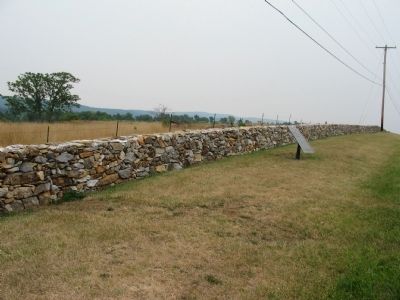
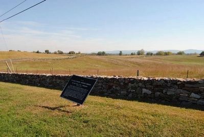
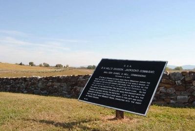
D.H. Hill's Division retired from South Mountain during the night of Sept. 14, crossed the Antietam, at the Middle Bridge, at daylight of the 15th, and formed line facing the Antietam on the high ground east of this road, its right near the Boonsboro Pike, its left on the Hagerstown Pike near the Bloody Lane. On the 15th and 16th it supported the artillery which was engaged with the Federal batteries beyond Antietam. Late on the 16th the Brigades of Colquitt and Ripley were moved to the left and occupied the fields near Mumma's House, connecting with the right of Hood's Division.
Erected by Antietam Battlefield Board. (Marker Number 332.)
Topics and series. This historical marker is listed in this topic list: War, US Civil. In addition, it is included in the Antietam Campaign War Department Markers series list. A significant historical month for this entry is September 1862.
Location. 39° 28.174′ N, 77° 44.702′ W. Marker is near Sharpsburg, Maryland, in Washington County. It is at the intersection of Sharpsburg Pike
this page online

Regionally, this marker is in Western Maryland. It is also in the American Mid-Atlantic, in Appalachia, and specifically in Northern Appalachia. Globally, it is in North America, the Western Hemisphere, the Western World, and the Anglosphere. Historically, it finds itself in what was once one of the original Thirteen Colonies.
Other nearby markers. At least 8 other markers are within walking distance of this marker: Longstreet's Command (about 400 feet away, measured in a direct line); a different marker also named Longstreet's Command (about 400 feet away); Anderson’s Division, Longstreet’s Command (about 600 feet away); D. H. Hill’s Division, Jackson’s Command (about 600 feet away); Colquitt's and Garland's Brigades (about 600 feet away); A.N.V. (about 600 feet away); a different marker also named Longstreet's Command (about 800 feet away); Sixth Army Corps (approx. 0.2 miles away). Touch for a list and map of
Photographed by Craig Swain, August 5, 2007
2. D.H. Hill's Division, Jackson's Command Marker
Related markers. Click here for a list of markers that are related to this marker. Virtual tour of the the Piper Farm by markers.
Also see . . .
1. Antietam Battlefield. National Park Service site. (Submitted on February 17, 2008, by Craig Swain of Leesburg, Virginia.)
2. Daniel Harvey Hill. Daniel Harvey Hill (July 12, 1821 – September 24, 1889) was a Confederate general during the American Civil War and a Southern scholar. (Submitted on September 21, 2015, by Brian Scott of Anderson, South Carolina.)
3. D. H. Hill's Division. D.H. Hill's five brigade division guarded the South Mountain passes and shielded the Army of Northern Virginia from the advancing Federals prior to the battle of Antietam. (Submitted on February 17, 2008, by Craig Swain of Leesburg, Virginia.)
Photographed by Brian Scott, September 19, 2015
3. D.H. Hill's Division, Jackson's Command Marker
Photographed by Brian Scott, September 19, 2015
4. D.H. Hill's Division, Jackson's Command Marker
Photographed by Craig Swain, August 5, 2007
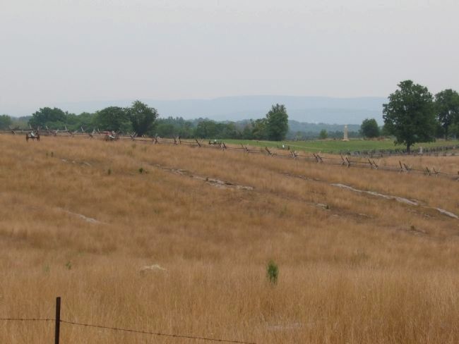
5. The Bloody Lane (Sunken Road) from the Hagerstown Pike
Looking over Piper's Farm fields toward the east. D.H. Hill's division manned a line based on the high ground here in the day prior to the battle of Antietam. Note the artillery pieces arranged across the field in the distance. These are posed as Confederate guns facing the Federal lines.
Photographed by Brian Scott
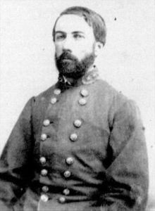
6. Lieutenant General Daniel Harvey Hill
(C.S.A.) (1821-1889)
(C.S.A.) (1821-1889)
President of Arkansas (1877-1884)
President of the Military and Agricultural College
of Milledgeville, Georgia (1885-1889)
Credits. This page was last revised on October 8, 2025. It was originally submitted on February 17, 2008, by Craig Swain of Leesburg, Virginia. This page has been viewed 1,200 times since then and 25 times this year. Photos: 1, 2. submitted on February 17, 2008, by Craig Swain of Leesburg, Virginia. 3, 4. submitted on September 21, 2015, by Brian Scott of Anderson, South Carolina. 5. submitted on February 17, 2008, by Craig Swain of Leesburg, Virginia. 6. submitted on September 21, 2015, by Brian Scott of Anderson, South Carolina.
