Sullivan in Hancock County, Maine — The American Northeast (New England)
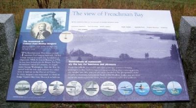
The view of Frenchman Bay
All the mountains that you see are part of Acadia National Park
The Age of Sail lingered into the 1900s as sailing ships proved more economical than steamships for carrying heavy cargos such as granite.
Generations of watercraft ply the bay for business and pleasure
From this hillside, you could once spot passenger steamers ferrying passengers to Bar Harbor; tugs towing great sailing ships carrying granite, ore, lumber and fish; and private yachts headed to the playgrounds of the wealthy in Sorrento, Grindstone Neck or Bar Harbor. Today you are more apt to see working lobster boats, kayaks, pleasure yachts and sailboats.
[Background photo caption reads]
Frenchman Bay in the Early 1900s
Reproduced from a historic postcard
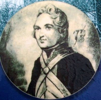
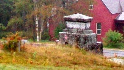
The monument to Colonel Paul Dudley Sargent
Revolutionary War Hero and Merchant, First County Justice and Judge of Probate (B. 1745, D. 1828)
The Revolutionary War almost ruined merchant Paul Sargent financially. He had a large interest in vessels lost by capture or shipwreck. While he was in Boston in 1772, he may have helped plan the Boston Tea Party. An intimate friend of Lafayette, he fought under George Washington. After the War, he retired with his wife and children to a small farm at Sullivan in the District of Maine. In 1820, Sargent's son organized an effort to bridge Taunton Bay from Hancock to Sullivan.
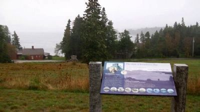
The monument to Colonel Sargent is to your left in the field below.
Photos courtesy of Sullivan Sorrento Historical Society, Gouldsboro Historical Society, Beatrice Buckley, and Acadia National Park
Erected by Maine Department of Transportation.
Topics. This historical marker is listed in these topic lists: Industry & Commerce • War, US Revolutionary • Waterways & Vessels. A significant historical year for this entry is 1745.
Location. 44° 31.343′ N, 68° 12.541′ W. Marker is in Sullivan, Maine, in Hancock County. Marker is on U.S. 1 near Benvenuto Avenue, on the right when traveling east. Marker is at a roadside pullout on the south side of U.S. 1. Touch for map. Marker is in this post office area: Sullivan ME 04664, United States of America. Touch for directions.
Other nearby markers. At least 8 other markers are within 5 miles of this marker, measured as the crow flies. Summer Rusticators, the Tourist Trade and the Waukeag House Hotel (a few steps from this marker); Historic Architecture in Sullivan Harbor (within shouting distance of this marker); Defenders of the Union (approx. 2.2 miles away); Franklin Veterans Memorial (approx. 4.6 miles away); Old Town Hall Site (approx. 4.6 miles away); Civil War Memorial (approx. 4.6 miles away); World War Memorial (approx. 4.6 miles away); Exhibit of the Granite Industry (approx. 4.8 miles away). Touch for a list and map of all markers in Sullivan.
Also see . . .
1. Frenchman Bay, Maine. (Submitted on April 21, 2012, by William Fischer, Jr. of Scranton, Pennsylvania.)
2. Biography of Colonel Paul Dudley Sargent. (Submitted on April 21, 2012, by William Fischer, Jr. of Scranton, Pennsylvania.)
Credits. This page was last revised on October 31, 2020. It was originally submitted on April 21, 2012, by William Fischer, Jr. of Scranton, Pennsylvania. This page has been viewed 675 times since then and 12 times this year. Photos: 1, 2, 3, 4. submitted on April 21, 2012, by William Fischer, Jr. of Scranton, Pennsylvania. 5. submitted on April 22, 2012, by William Fischer, Jr. of Scranton, Pennsylvania.
