Milford in South Central Region, Connecticut — The American Northeast (New England)
Peter Pond
1740 - 1807
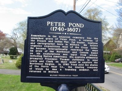
Photographed by Michael Herrick, April 15, 2012
1. Peter Pond Marker
Erected by Milford Preservation Trust.
Topics and series. This historical marker is listed in these topic lists: Colonial Era • Exploration. In addition, it is included in the Former U.S. Presidents: #03 Thomas Jefferson, and the Lewis & Clark Expedition series lists. A significant historical year for this entry is 1740.
Location. 41° 13.575′ N, 73° 3.029′ W. Marker is in Milford in South Central Region, Connecticut. It is at the intersection of Gulf Street and Cherry Street, on
this page online

Regionally, this marker is in the Connecticut River Valley, on the Connecticut Shoreline, and in Greater New Haven. It is also in the American Northeast, in New England, and on the Eastern Seaboard. Globally, it is in the North Atlantic Region, North America, the Western Hemisphere, the Western World, and the Anglosphere. Historically, it finds itself in what was once New Haven County and also one of the original Thirteen Colonies.
Other nearby markers. At least 8 other markers are within walking distance of this marker: George W. Baird (about 300 feet away, measured in a direct line); Early Post Office Site (approx. 0.3 miles away); Memorial to Three Milford Men (approx. 0.3 miles away); Jefferson Bridge (approx. 0.4 miles away); Milford Memorial Stone Bridge (approx. 0.4 miles away); Arctic Engine Co. No. 1 (approx. 0.4 miles away); Home Site of Robert Treat (approx. 0.4 miles away); Milford Remembers (approx. 0.4 miles away).
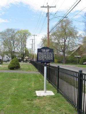
Photographed by Michael Herrick, April 15, 2012
2. Peter Pond Marker
Also see . . . Peter Pond on Wikipedia. (Submitted on April 22, 2012, by Michael Herrick of Southbury, Connecticut.)
Credits. This page was last revised on May 19, 2026. It was originally submitted on April 22, 2012, by Michael Herrick of Southbury, Connecticut. This page has been viewed 1,209 times since then and 45 times this year. Photos: 1, 2. submitted on April 22, 2012, by Michael Herrick of Southbury, Connecticut.
