Greenbrier West in Chesapeake, Virginia — The American South (Mid-Atlantic)
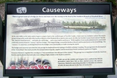
Causeways
In the mid-1600s, as the early settlers began to acquire land in the southern part of Norfolk County, a land route was needed to connect the area to people living on the north side of the Southern Branch of the Elizabeth River and its wide marsh. In 1686, the Norfolk County Court ordered “that Mr. Tho. Butt bee head Surveyor…and make the said bridge…and a clear road to and from it.” With neighbors from nearby plantations he constructed a half mile system of narrow “causeys” and four bridges. The longest bridge crossed the Southern Branch and became known as the Great Bridge. The “causeys,” or causeways, as distinguished from the bridges, were raised paths or roads crossing the marsh.
The bridges and causeways provided the only passage for landward travelers going to Norfolk via Kemp’s Landing. The passage led to the development of the “Great Road” that made possible the transportation of goods, supplies and livestock from North Carolina to markets in Virginia.
Governor Dunmore regarded the crossing as a “very essential pass into this part of the country.” The passage was so important to both the American Patriots and the British that both sides were willing to fight a battle to the death to control it.
(sidebar)
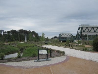
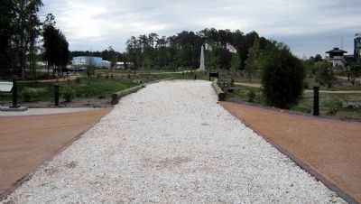
Walk out on the exhibit and imagine how confined the British grenadiers must have felt as they started across the narrow causeway, limited to marching shoulder to shoulder in columns of only six men abreast in the face of enemy fire.
Erected 2012 by Great Bridge Battlefield & Waterways History Foundation.
Topics. This historical marker is listed in these topic lists: Bridges & Viaducts • Roads & Vehicles • War, US Revolutionary. A significant historical year for this entry is 1686.
Location. 36° 43.326′ N, 76° 14.376′ W. Marker is in Chesapeake, Virginia. It is in Greenbrier West. Marker can be reached from the intersection of North Battlefield Boulevard (Business Virginia Route 168) and Watson Road, on the left when traveling south. Touch for map. Marker is in this post office area: Chesapeake VA 23320, United States of America. Touch for directions.
Other nearby markers. At least 8 other markers are within walking distance of this marker. At Dawn On December 9, 1775 (a few steps from this marker); Causeway Construction (a few steps from this marker); First Fire (within shouting distance of this marker); Liberty to Slaves (within shouting distance of this marker); Site of the Original Causeway (within shouting distance of this marker); The Day is Our Own! (within shouting distance of this marker); Fort Murray (within shouting distance of this marker); Billy Flora (about 300 feet away, measured in a direct line). Touch for a list and map of all markers in Chesapeake.
Also see . . . Great Bridge Battlefield & Waterways History Foundation. (Submitted on April 29, 2012, by Bernard Fisher of Richmond, Virginia.)
Credits. This page was last revised on February 1, 2023. It was originally submitted on April 29, 2012, by Bernard Fisher of Richmond, Virginia. This page has been viewed 704 times since then and 13 times this year. Photos: 1, 2, 3, 4, 5. submitted on April 29, 2012, by Bernard Fisher of Richmond, Virginia.
Editor’s want-list for this marker. Check actual location of marker and its GPS coords. • Can you help?


