Sharpsburg in Washington County, Maryland — The American Northeast (Mid-Atlantic)
"The End of the Confederacy Was In Sight"
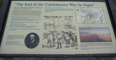
Major General Edwin Sumner commanded the Second Corps, largest corps in the Union Army of the Potomac - but he never could get his three divisions together.
His lead division was broken in the West Woods. Brigadier General William French's division smashed itself on the Confederate line in the Sunken Road. Finally Major General Israel Richardson's division came up beside French's and gained a position from which they could fire down the length of the Sunken Road. Then, as a Southerner remembered:
"The minnie balls, shot and shell rained upon us from every direction except the rear."
Orders were misunderstood. Two Confederate regiments pulled out of the line. The rest of the line crumbled:
"We had either to run or surrender; we ran rapidly through a large orchard."
"The slaughter was terrible"
Southern commanders pulled in men and guns from all directions to form a new line on the Piper farm.
"Lee's army was ruined and the end of the Confederacy was in sight."
General Richardson saw the chance. He tried desperately to mount the attack that would break Lee's army in half. He was wounded by a shellburst and the attack was never made.
"No one but a soldier could understand our sorrow at seeing him carried off the field."
Richardson died of his wound November 3.
Southern Major General James Longstreet wrote:
"I put my staff officers to the guns while I held their horses...They seemed to forget they had known fatigue. The guns were played with life, and the brave spirits manning them claimed that they were there to hold or go down with the guns."
The Rebel line held.
Hours later the 7th Maine Regiment was ordered across the Sunken road, now Bloody Lane. Half of the men were killed or wounded in the fields around the Piper farm. The regimental commander was sure the attack had been ordered by a drunken colonel:
"I wish I had been old enough, or distinguished enough, to have dared to disobey orders."
Topics. This historical marker is listed in this topic list: War, US Civil. A significant day of the year for for this entry is November 3.
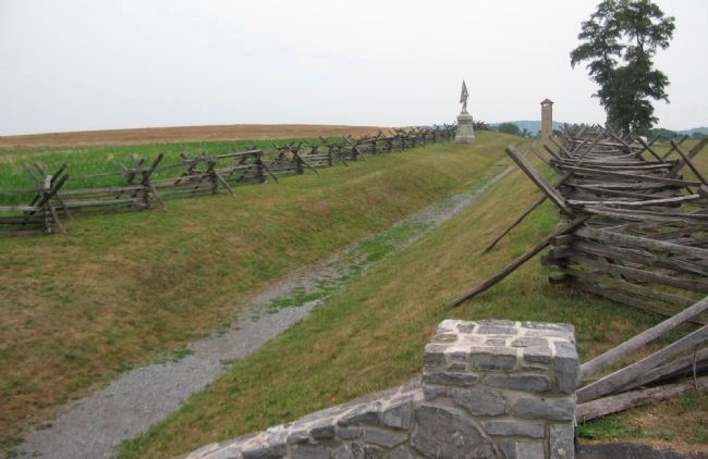
Location. This marker has been replaced by another marker nearby. 39° 28.259′ N, 77° 44.36′ W. Marker is in Sharpsburg, Maryland, in Washington County. Marker is on Richardson Avenue, on the left when traveling east. Located at the Sunken Road overlook stop. Touch for map. Marker is in this post office area: Sharpsburg MD 21782, United States of America. Touch for directions.
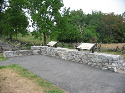
Other nearby markers. At least 8 other markers are within walking distance of this location. Heaps Upon Heaps Were There in Death's Embrace (here, next to this marker); A Simple Farm Lane Changed Forever (here, next to this marker); "These Men Are Going to Stay Here" (here, next to this marker); The 14th Indiana Infantry (within shouting distance of this marker); 8th Ohio Regiment (within shouting distance of this marker); 132nd Pennsylvania Volunteer Infantry (within shouting distance of this marker); Second Army Corps (about 300 feet away, measured in a direct line); Jackson's Command (about 300 feet away). Touch for a list and map of all markers in Sharpsburg.
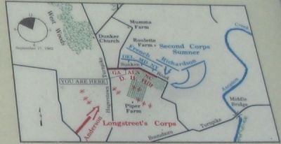
More about this marker. On the lower left of the marker is a portrait of General Richardson. In the center is a depiction of Gen. Longstreet holding his staff's horses while they service cannon. On the upper right is a map depicting the action at this phase of the battle. In the lower right is a portion of a painting by Union Captain James Hope, showing the action at the Sunken Road.
Regarding "The End of the Confederacy Was In Sight". This marker is included on the Sunken Road or Bloody Lane Virtual Tour by Markers see the Virtual tour link below to see the markers in sequence.
This marker was replaced by another named Heaps Upon Heaps Were There in Death's Embrace (See nearby markers).
Also see . . . Antietam Battlefield. National Park Service site. (Submitted on February 18, 2008, by Craig Swain of Leesburg, Virginia.)
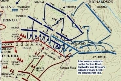
via American Battlefield Trust, unknown
5. Sunken Road or Bloody Lane Virtual Tour by Markers.
A collection of markers interpreting the action of during the Battle of Antietam around the Sunken Road.
(Submitted on February 23, 2008, by Craig Swain of Leesburg, Virginia.)
Click for more information.
(Submitted on February 23, 2008, by Craig Swain of Leesburg, Virginia.)
Click for more information.
Credits. This page was last revised on April 3, 2022. It was originally submitted on February 18, 2008, by Craig Swain of Leesburg, Virginia. This page has been viewed 1,262 times since then and 22 times this year. Photos: 1, 2, 3, 4. submitted on February 18, 2008, by Craig Swain of Leesburg, Virginia. 5. submitted on April 3, 2022, by Larry Gertner of New York, New York.
