Near Welshpool in Charlotte County, New Brunswick — The Atlantic Provinces (North America)
Lubec, Maine
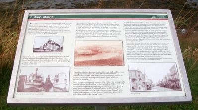
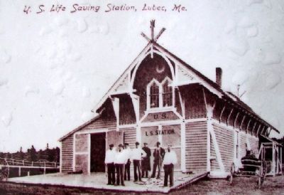
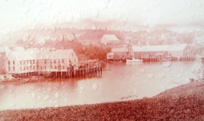
About 1840, a canal connecting Johnson and South Bays was dug in North Lubec and a dam constructed there to harness tidal energy to power plaster mills. Gypsum (the raw product used to make plaster) and grindstones from the Maritimes were important trade goods. Lubec’s mills manufactured plaster as late as 1858. In 1874, shipping traffic to and from Lubec was so extensive that the U.S. Coast Guard constructed a life-saving station at West Quoddy Head.
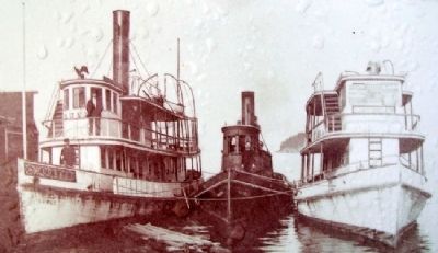
About that time, passenger ferries carried their fares around the bay between the communities of Lubec, Eastport, North Lubec, and Welshpool. One of the later ferries had a capacity of 350 passengers and made trips to Deer Island, St. Andrews, St. Stephen, and Calais.
The smoked herring industry prospered until about 1870 when it gradually began to decline, paving the way for a new industry. Lubec’s first sardine cannery was built in 1880, and in 1890, the height of the industry, 22 sardine canneries, a fertilizer plant, and a can-manufacturing plant were operating in various parts of the town. Canneries carried imaginative names like the Penny Catcher, Honey Pot, Salve Box, Drunkard’s Dream, and Battle Axe. The town’s population was 3,005, and families came from towns up to 129 kilometres (80 miles) away to spend the season working in the factories or at factory-related jobs.
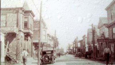
The shipbuilding, shipping, smoked herring, and sardine years were prosperous years in Lubec. Home and business construction boomed and rural areas benefited by supplying lumber, stakes for herring weirs, crops, dairy products, livestock, and fish.
With the advent of steam power in the 1880s, the sailing trade and its related shipbuilding began to decline. Side-wheel and eventually propeller-driven steamers traveled three times a week between Boston, Portland, Lubec, and Saint John. Sardines, smoked herring, and potatoes were shipped from Lubec and mustard, oil, tin, general cargo, and passengers were off-loaded at the town’s piers.
In 1898, the Electrolytic Marine Salts Company came to town, perpetuating a hoax by claiming the “accumulators” at their two North Lubec factories could extract gold from seawater. Before the hoax was discovered, many shares of company stock were sold to prosperous investors from southern New England.
American engineer Dexter Cooper, in 1919, proposed his first of several plans to capture energy stored in Passamaquoddy Bay’s tides. Franklin D. Roosevelt was a strong proponent of tidal power and the U.S. Corps of Army Engineers began dam construction in 1935. Although the Engineers completed two small dams in Eastport and a portion of a third of Lubec, Congress failed to appropriate additional funds
and the project was abandoned in 1936.
The smoked herring and sardine canning industries are now absent from Lubec’s shores, with the last sardine cannery closing in 2001. Fishing – including aquaculture and the harvesting of lobster, scallops, clams, sea urchins, and sea cucumbers – remains an important local industry. Lubec families also find employment in tourism, health care, and small entrepreneurial businesses. Seasonal occupations such as blueberry-raking and gathering fir boughs for Christmas wreaths also contribute to the local economy.
——————
Photos courtesy Lubec Historical Society, Bev Trenholm, Pauline Bailey, and Edith Comstock. Historical resources: Lubec Herald and 200 Years of Lubec History.
Erected by Roosevelt Campobello International Park.
Topics and series. This historical marker is listed in these topic lists: Industry & Commerce • Settlements & Settlers • Waterways & Vessels. In addition, it is included in the Former U.S. Presidents: #32 Franklin D. Roosevelt series list. A significant historical year for this entry is 1840.
Location. 44° 51.785′ N, 66° 58.761′ W. Marker is near Welshpool, New Brunswick, in Charlotte County. Marker is on the grounds of Mulholland Point Lighthouse, off Narrows
Road, and about 0.5 kilometers north of the FDR Memorial Bridge, in Roosevelt Campobello International Park. Touch for map. Marker is in this post office area: Welshpool NB E5E 1A4, Canada. Touch for directions.
Other nearby markers. At least 8 other markers are within walking distance of this marker. A different marker also named Lubec, Maine (here, next to this marker); Mulholland Point / La pointe Mulholland (a few steps from this marker); First Meeting Place of Washington Lodge No. 37 F.&A.M. (approx. 0.4 kilometers away in the U.S.); Civil War Memorial (approx. half a kilometer away in the U.S.); Lubec Veterans Honor Roll (approx. half a kilometer away in the U.S.); War Memorial (approx. half a kilometer away in the U.S.); Dawn's First Light Shines on Free Masonry (approx. half a kilometer away in the U.S.); Roosevelt Campobello International Park (approx. 1.6 kilometers away). Touch for a list and map of all markers in Welshpool.
More about this marker. An identical French-language marker is nearby.
Also see . . . Lubec, Maine, History. (Submitted on May 1, 2012, by William Fischer, Jr. of Scranton, Pennsylvania.)
Credits. This page was last revised on August 16, 2017. It was originally submitted on May 1, 2012, by William Fischer, Jr. of Scranton, Pennsylvania. This page has been viewed 1,148 times since then and 29 times this year. Photos: 1, 2, 3, 4, 5, 6. submitted on May 1, 2012, by William Fischer, Jr. of Scranton, Pennsylvania.
