Guymon in Texas County, Oklahoma — The American South (West South Central)
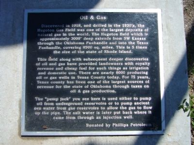
Oil & Gas
This field along with subsequent deeper discoveries of oil and gas have provided landowners with royalty revenue and cheap fuel for such things as irrigation and domestic use. There are nearly 8000 producing oil and gas wells in Texas County today. For 75 years, Texas County has been one of the largest sources of revenue for the state of Oklahoma through taxes on oil & gas production.
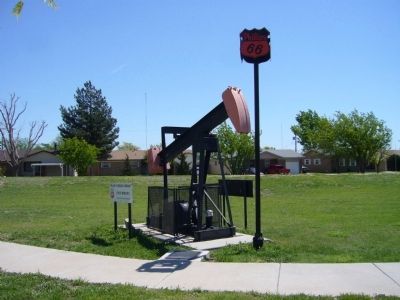
The “pump jack” you see here is used either to pump oil from underground reservoirs or to pump ancient sea water from gas reservoirs to allow the gas to flow up the pipe. The salt water is later put back where it came from through an injection well.
Erected by Phillip's Petroleum.
Topics. This historical marker is listed in these topic lists: Environment • Industry & Commerce. A significant historical year for this entry is 1918.
Location. 36° 40.633′ N, 101° 28.42′ W. Marker is in Guymon, Oklahoma , in Texas County. Marker can be reached from the intersection of U.S. 412 and U.S. 54. Marker is in Centennial Park. Enter from Park Avenue on east side of park. Touch for map. Marker is in this post office area: Guymon OK 73942, United States of America. Touch for directions.
Other nearby markers. At least 6 other markers are within walking distance of this marker. The Pig (a few steps from this marker); The Cow (within shouting distance of this marker); Guymon, Texas County, Oklahoma (within shouting distance of this marker); E.T. Guymon (within shouting distance of this marker); Panhandle Area Natural Gas (approx. 0.3 miles away); "Trees" of the Prairie (approx. 0.3 miles away).
Credits. This page was last revised on June 16, 2016. It was originally submitted on May 11, 2012, by Bill Kirchner of Tucson, Arizona. This page has been viewed 565 times since then and 14 times this year. Photos: 1, 2. submitted on May 11, 2012, by Bill Kirchner of Tucson, Arizona. • Bernard Fisher was the editor who published this page.

