Near Meade in Meade County, Kansas — The American Midwest (Upper Plains)
The Lone Tree Incident
Photographed by Bill Kirchner, April 17, 2012
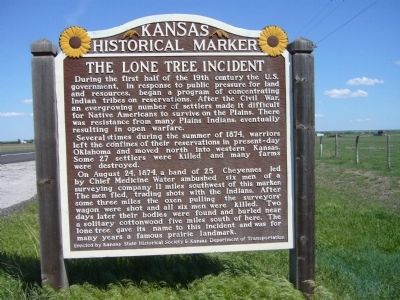
1. The Lone Tree Incident Marker
During the first half of the 19th century the U.S. government, in response to public pressure for land and resources, began a program of concentrating Indian tribes on reservations. After the Civil War, an ever growing number of settlers made it difficult for Native Americans to survive on the Plains. There was resistance from many Plains Indians, eventually resulting in open warfare.
Several times during the summer of 1874, warriors left the confines of their reservations in present-day Oklahoma and moved north into western Kansas. Some 27 settlers were killed and many farms were destroyed.
On August 24, 1874, a band of 25 Cheyennes led by Chief Medicine Water ambushed six men of a surveying company 11 miles southwest of this marker. The men fled, trading shots with the Indians. After three miles the oxen pulling the surveyors' wagon were shot and all six men were killed. Two days later their bodies were found and buried near a solitary cottonwood five miles south of here. The lone tree gave its name to this incident and was for many years a famous prairie landmark.
Erected by Kansas State Historical Society
this page online
Topics and series. This historical marker is listed in these topic lists: Indigenous Peoples and Communities • Wars, US Indian. In addition, it is included in the Kansas Historical Society series list. A significant historical year for this entry is 1874.
Location. 37° 17.125′ N, 100° 22.068′ W. Marker is near Meade, Kansas, in Meade County. It is on U.S. 54 at milepost 42.5, on the right when traveling east. Touch for map. Marker is in this post office area: Meade KS 67864, United States of America. Touch for directions.

Regionally, this marker is in the American Midwest, in the Corn Belt, on the prairies, on the Great Plains, on the Southern Plains, on the High Plains, and on the Santa Fe Trail Corridor. Globally, it is in North America, the Western Hemisphere, the Western World, and the Anglosphere. Historically, it finds itself in what was once New Spain, the Comanchería, the Dust Bowl, the Louisiana Purchase, and the Republic of Texas.
Other nearby markers. At least 8 other markers are within 3 miles of this marker, measured as the crow flies: Meade County
Photographed by Bill Kirchner, April 17, 2012
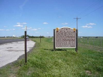
2. The Lone Tree Incident Marker
Photographed by Bill Kirchner, October 5, 2014
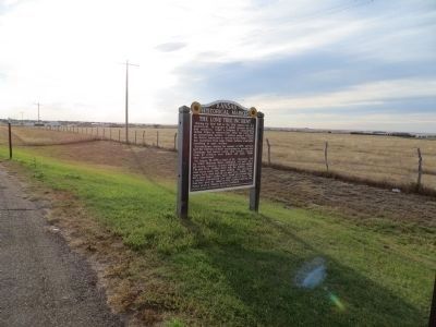
3. The Lone Tree Incident Marker
Credits. This page was last revised on December 16, 2024. It was originally submitted on May 11, 2012, by Bill Kirchner of Tucson, Arizona. This page has been viewed 6,425 times since then and 611 times this year. Photos: 1, 2. submitted on May 11, 2012, by Bill Kirchner of Tucson, Arizona. 3. submitted on November 11, 2014, by Bill Kirchner of Tucson, Arizona. • Bill Pfingsten was the editor who published this page.
