Near Winnabow in Brunswick County, North Carolina — The American South (South Atlantic)
Brunswick Town State Historic Site
Photographed by J. J. Prats, January 15, 2008
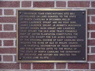
1. Brunswick Town State Historic Site Marker
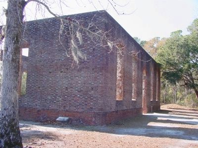
Brunswick Town State Historic Site was established on land donated to the State of North Carolina in December, 1952, by James Laurence Sprunt and his four sons, James Laurence Sprunt, Jr., Kenneth Murchison Sprunt, Samuel Nash Sprunt, and Laurence Gray Sprunt. The 114.5-acre tract, formerly part of Orton Plantation, constitutes the entire site except for 5.25 acres donated by the Episcopal Diocese of East Carolina which includes the ruins of Old St. Philips church.
In grateful recognition of these generous and public-spirited gifts to the people of the State of North Carolina the Department of Archives and History has erected this plaque, June 30, 1972.
Erected 1972 by Department of Archives and History.
Topics. This historical marker is listed in these topic lists: Colonial Era • Religion & Religious Structures. A significant historical date for this entry is June 30, 1881.
Location. 34° 2.388′ N, 77° 56.778′ W. Marker is near Winnabow, North Carolina, in Brunswick County. It is on St. Philips Road east of River Road (North Carolina Highway 133). Follow the signs on River Road. Take Plantation Road to St. Philips Road.
this page online

Regionally, this marker is in the Coastal Plain and on the Cape Fear Coast. It is also in the American South, specifically in the Upper South, in the Tidewater, and on the Eastern Seaboard. Globally, it is in the North Atlantic Region, North America, the Western Hemisphere, the Western World, and the Anglosphere. Historically, it finds itself in what was once the territory of the Mississippian Culture, one of the original Thirteen Colonies, one of the Confederate States of America, and the Antebellum South.
Other nearby markers. At least 8 other markers are within walking distance of this marker: John LaPierre (within shouting distance of this marker); Brunswick Town (within shouting distance of this marker); Fort Anderson (within shouting distance of this marker); Colonel Maurice Moore (within shouting distance of this marker); St. Phillips Church Interior (about 300 feet away, measured in a direct line); Margaret McCorkall: A Brunswick Woman (about 500 feet away); The Big Guns Of Fort Anderson
Photographed by J. J. Prats, January 15, 2008
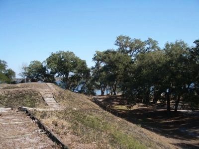
2. Fort Anderson Earthworks (Civil War)
More about this marker. It is on the wall of the visitor’s center.
Regarding Brunswick Town State Historic Site. “A major pre-Revolutionary port on North Carolina’s Cape Fear River, Brunswick was razed by British troops in 1776 and never rebuilt. During the Civil War, Fort Anderson was constructed atop the old village site. Colonial foundations dot the present-day tour trail, which crosses the earthworks of the Confederate fort. This serene riverside setting, colonial and Civil War history, and colorful exhibits will be long remembered by visitors. ”
Also see . . . Brunswicktown/Fort Anderson. Project 543 entry (Submitted on February 28, 2021, by Larry Gertner of New York, New York.)
Photographed by J. J. Prats, January 15, 2008
3. Ruins of Old St. Philips Church (Colonial)
Photographed by J. J. Prats, January 15, 2008
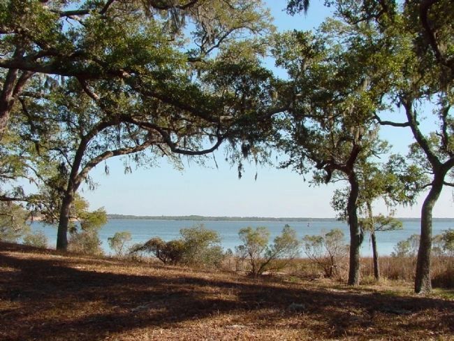
4. View of the Cape Fear River From Where the Town Stood
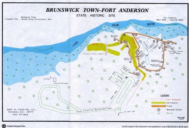
5. Map of Present-Day Historic Site
An 11" x 14" copy of this map is available at at the visitor’s center. Click on this image to enlarge.
Credits. This page was last revised on February 28, 2021. It was originally submitted on February 19, 2008, by J. J. Prats of Powell, Ohio. This page has been viewed 3,954 times since then and 48 times this year. Photos: 1, 2, 3, 4. submitted on February 19, 2008, by J. J. Prats of Powell, Ohio. 5. submitted on August 12, 2008, by J. J. Prats of Powell, Ohio.
Editor’s want-list for this marker. Wide shot of the visitor’s center showing the marker. • Can you help?
