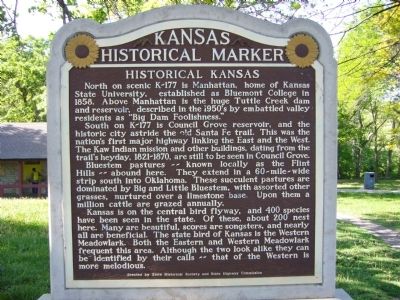
Historical Kansas
South on K-177 is Council Grove reservoir, and the historic city astride the old Santa Fe trail. This was the nation's first major highway linking the East and the West. The Kaw Indian mission and other buildings, dating from the trail's heyday, 1821-1870, are still to be seen in Council Grove.
Bluestem pastures--known locally as the Flint Hills--abound here. They extend in a 60-mile-wide strip south into Oklahoma. These succulent pastures are dominated by Big and Little Bluestem, with assorted other grasses, nurtured over a limestone base. Upon them a million cattle are grazed annually.
Kansas is on the central bird flyway, and 400 species have been seen in the state. Of these, about 200 nest here. Many are beautiful, scores are songsters, and nearly all are beneficial. The state bird of Kansas is the Western Meadowlark. Both the Eastern and Western Meadowlark frequent this area. Although the two look alike they can be identified by their calls - that of the Western is more melodious.
Erected by State Historical Society and State Highway
Topics and series. This historical marker is listed in these topic lists: Animals • Environment • Settlements & Settlers. In addition, it is included in the Kansas Historical Society series list. A significant historical year for this entry is 1858.
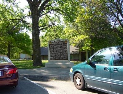
Location. 39° 3.883′ N, 96° 36.867′ W. Marker is near Manhattan, Kansas, in Geary County. Marker can be reached from Interstate 70 at milepost 310. Marker is in the east bound rest area. Touch for map. Marker is in this post office area: Manhattan KS 66502, United States of America. Touch for directions.
Other nearby markers. At least 8 other markers are within 7 miles of this marker, measured as the crow flies. Fort Riley & Junction City (approx. 0.4 miles away); a different marker also named Historical Kansas (approx. 0.4 miles away); Purple Heart Trail in Kansas (approx. half a mile away); The Tallgrass Prairie (approx. 6.1 miles away); Konza Prairie (approx. 6.2 miles away); Geology at Konza (approx. 6.2 miles away); Veteran's Memorial (approx. 6.3 miles away); Ogden (approx. 6.3 miles away). Touch for a list and map of all markers in Manhattan.
Credits. This page was last revised on June 16, 2016. It was originally submitted on May 14, 2012, by Bill Kirchner of Tucson, Arizona. This page has been viewed 682 times since then and 15 times this year. Photos: 1, 2. submitted on May 14, 2012, by Bill Kirchner of Tucson, Arizona. • Bill Pfingsten was the editor who published this page.

