Near Sharpsburg in Washington County, Maryland — The American Northeast (Mid-Atlantic)
Second Army Corps
Caldwell's Brigade, Richardson's Division
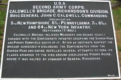
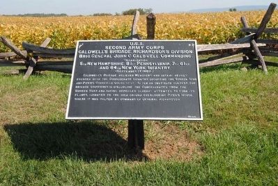
Second Army Corps.
Caldwell's Brigade, Richardson's Division.
Brig. General John C. Caldwell, Commanding.
Organization
5th New Hampshire, 81st Pennsylvania, 7th, 61st, and 64th New York Infantry.
(September 17, 1862)
Caldwell's Brigade relieved Meagher's and became heavily engaged with the Confederate Infantry, occupying the Sunken Road and Piper's Cornfield south of it. After an obstinate contest, the Brigade succeeded in dislodging the Confederates from the Sunken Road and, having repelled several attempts to turn its flanks, advanced to the high ground overlooking Piper's House where it was halted by command of General Richardson.
Erected by Antietam Battlefield Board. (Marker Number 45.)
Topics and series. This historical marker is listed in this topic list: War, US Civil. In addition, it is included in the Antietam Campaign War Department Markers series list. A significant historical date for this entry is September 17, 1862.
Location. 39° 28.206′ N, 77° 44.236′ W. Marker is near Sharpsburg, Maryland, in Washington County. Marker is on Richardson Avenue, on the left when traveling east. Located at a tablet cluster near the Sunken Road, stop eight on the driving tour of Antietam. Touch for map. Marker is in this post office area: Sharpsburg MD 21782, United States of America. Touch for directions.
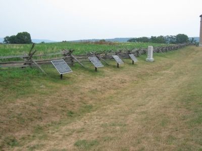
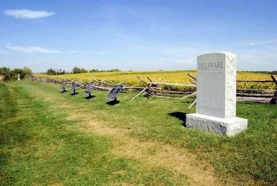
Other nearby markers. At least 10 other markers are within walking distance of this marker. A different marker also named Second Army Corps (here, next to this marker); a different marker also named Second Army Corps (here, next to this marker); 2nd Delaware (a few steps from this marker); Richardson's Division, Second Army Corps (a few steps from this marker); Anderson’s Division, Longstreet’s Command (within shouting distance of this marker); Brigadier General George B. Anderson (about 300 feet away, measured in a direct line); Army of the Potomac (about 300 feet away); September 16, 1862 (about 300 feet away); September 17, 1862 (about 300 feet away); September 17, 1862 (Continued) (about 300 feet away). Touch for a list and map of all markers in Sharpsburg.
Regarding Second Army Corps. This marker is included on the Sunken Road or Bloody Lane Virtual Tour by Markers see the Virtual tour link below to see the markers in sequence.
Also see . . .
1. Antietam Battlefield. National Park Service site. (Submitted on February 19, 2008, by Craig Swain of Leesburg, Virginia.)
2. 1st Brigade, 1st Division, II Corps. Lieutenant Theodore W. Greig, of the 61st New York, received the Medal of Honor for actions at the battle. He rushed forward to seize an enemy regiment's colors during the fighting here at Sunken Road. (Submitted on February 19, 2008, by Craig Swain of Leesburg, Virginia.)
3. John C. Caldwell. John Curtis Caldwell (April 17, 1833 – August 31, 1912) was a teacher, a Union general in the American Civil War, and an American diplomat. (Submitted on September 27, 2015, by Brian Scott of Anderson, South Carolina.)
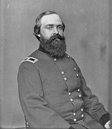
Photographed By Brian Scott
5. Brig. General John C. Caldwell (1833-1912)
At the Battle of Antietam, on September 17, 1862, he briefly led his division when its commander, major general Israel B. Richardson, was wounded. Caldwell himself was wounded in the battle and he received criticism that he handled his brigade poorly in the assault on the sunken road in the center of the Confederate line (the sunken road, or "Bloody Lane"). There were also rumors spread that he had hidden in the rear to avoid direct contact with the enemy.
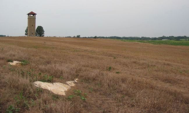
Photographed By Craig Swain, August 5, 2007
6. Caldwell's Brigade Attacks the Sunken Road
Originally facing at an oblique angle, essentially refusing the left of Richardson's Division. As Meager's Brigade faced heavy resistance, Caldwell's Brigade moved across the field in the foreground here and drove against the Sunken Road. The observation tower serves as a point of reference, roughly the east most point of the Bloody Lane defensive line, which extends from that point to the right of the photo.
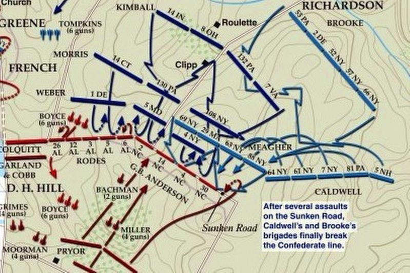
via American Battlefield Trust, unknown
7. Sunken Road or Bloody Lane Virtual Tour by Markers.
A collection of markers interpreting the action of during the Battle of Antietam around the Sunken Road.
(Submitted on February 23, 2008, by Craig Swain of Leesburg, Virginia.)
Click for more information.
(Submitted on February 23, 2008, by Craig Swain of Leesburg, Virginia.)
Click for more information.
Credits. This page was last revised on April 3, 2022. It was originally submitted on February 19, 2008, by Craig Swain of Leesburg, Virginia. This page has been viewed 904 times since then and 12 times this year. Photos: 1. submitted on February 19, 2008, by Craig Swain of Leesburg, Virginia. 2. submitted on September 27, 2015, by Brian Scott of Anderson, South Carolina. 3. submitted on February 18, 2008, by Craig Swain of Leesburg, Virginia. 4, 5. submitted on September 27, 2015, by Brian Scott of Anderson, South Carolina. 6. submitted on February 19, 2008, by Craig Swain of Leesburg, Virginia. 7. submitted on April 3, 2022, by Larry Gertner of New York, New York.
