Norvelt in Westmoreland County, Pennsylvania — The American Northeast (Mid-Atlantic)
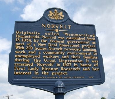
Norvelt
Erected 2002 by Pennsylvania Historical and Museum Commission.
Topics and series. This historical marker is listed in these topic lists: Industry & Commerce • Labor Unions • Women. In addition, it is included in the Eleanor Roosevelt, and the Pennsylvania Historical and Museum Commission series lists. A significant historical date for this entry is April 13, 1883.
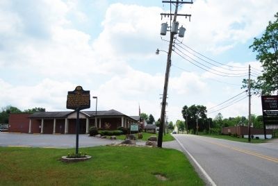
Location. 40° 12.565′ N, 79° 29.847′ W. Marker is in Norvelt, Pennsylvania, in Westmoreland County. Marker is on Mt Pleasant Road, 0.1 miles north of Iris Lane, on the right when traveling north. Located at Norvelt Fire Department. Touch for map. Marker is in this post office area: Norvelt PA 15674, United States of America. Touch for directions.
Other nearby markers. At least 8 other markers are within 5 miles of this marker, measured as the crow flies. Standard Shaft Mine and Coke Works (approx. 3.7 miles away); Transportation (approx. 4.7 miles away); Arts & Culture (approx. 4.7 miles away); Industry (approx. 4.7 miles away); A History of Glass (approx. 4.7 miles away); The Story of Penn Park (approx. 4.7 miles away); General Edward Braddock and His Army (approx. 4.8 miles away); Braddock's Military Road 1755 (approx. 4.8 miles away).
Also see . . . Norvelt - Behind the Marker. ExplorePAHistory.com (Submitted on May 22, 2012, by Mike Wintermantel of Pittsburgh, Pennsylvania.)
Credits. This page was last revised on July 31, 2020. It was originally submitted on May 22, 2012, by Mike Wintermantel of Pittsburgh, Pennsylvania. This page has been viewed 564 times since then and 18 times this year. Photos: 1, 2. submitted on August 23, 2013, by Mike Wintermantel of Pittsburgh, Pennsylvania.

