Waynesville in Pulaski County, Missouri — The American Midwest (Upper Plains)
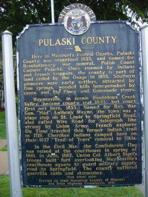
Pulaski County
Here in Missouri's central Ozarks, Pulaski County was organized 1833, and named for Revolutionary War general, Polish Count Casimir Pulaski. Once roamed by Indians and French trappers, the county is part of land ceded by the Osage in 1808. Southern pioneers were early settlers, attracted by fine springs, wooded hills honeycombed by caves, and Big Piney and Gasconade Rivers.
Waynesville, in scenic Roubidoux Creek Valley, became the county seat 1843, but court first met here, 1835. Named for Rev. War Gen. "Mad" Anthony Wayne, the town was a stage stop on St. Louis to Springfield Road, also called Wire Road for telegraph line strung by Union Army. French explorer Du Tisne traveled this former Indian Trail in 1719. Cherokee Indians camped here on their 1837 "Trail of Tears" removal to Okla.
In the Civil War, the Confederate flag was raised at the courthouse in spring of 1861. In June, 1862, Union Col. Albert Sigel's troops built fort overlooking Waynesville's courthouse square to guard military supply road to Springfield. The county suffered guerrilla raids and skirmishes.
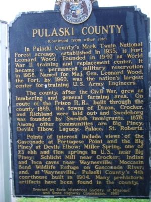
In Pulaski County's Mark Twain National Forest acreage, established in 1935, is Fort Leonard Wood. Founded in 1940 as World War II training and replacement center, it became a permanent military reservation in 1958. Named for Maj. Gen. Leonard Wood, the Fort, by 1960, was the nation's largest center for training U.S. Army Engineers.
The county, after the Civil War, grew as lumbering and general farming area. On route of the Frisco R.R., built through the county 1869, the towns of Dixon, Crocker, and Richland were laid out and Swedeborg was founded by Swedish immigrants, 1878. Among other communities are Big Piney, Devils Elbow, Laguey, Palace, St. Roberts.
Points of interest include views of the Gasconade at Portuguese Point and the Big Piney at Devils Elbow; Miller Spring, one of 23 ebb and flow springs in U.S., near Big Piney; Schlicht Mill near Crocker; Indian and Inca caves near Waynesville; Moccasin Bend Wildlife Refuge on Gasconade River; and, at Waynesville, Pulaski County's 4th courthouse built in 1904. Many prehistoric artifacts have been found in the county
Erected 1961 by State Historical Society of Missouri and State Highway Commission.
Topics and series. This historical marker is listed in these topic lists: Settlements & Settlers • War, US Civil. In addition, it is included in the Missouri, The State Historical Society of series list. A significant historical month for this entry is June 1862.
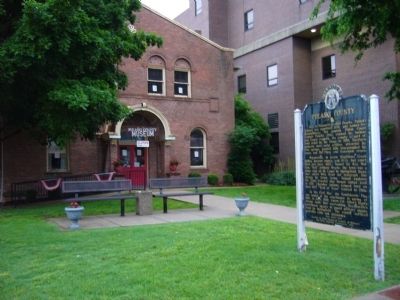
Location. 37° 49.732′ N, 92° 12.085′ W. Marker is in Waynesville, Missouri, in Pulaski County. Marker is at the intersection of Historic Route 66 and Benton Street, on the right when traveling west on Historic Route 66. Marker is on the old courthouse lawn. Touch for map. Marker is in this post office area: Waynesville MO 65583, United States of America. Touch for directions.
Other nearby markers. At least 8 other markers are within walking distance of this marker. Rigsby House and Standard Oil Station (within shouting distance of this marker); Old Stage Coach Stop (about 300 feet away, measured in a direct line); Talbot House (about 500 feet away); Waynesville Fort (about 700 feet away); James Richard Livingston (approx. 0.2 miles away); A Road Through History (approx. 0.2 miles away); Discover a Hidden History (approx. 0.2 miles away); What is the Trail of Tears? (approx. 0.2 miles away). Touch for a list and map of all markers in Waynesville.
Credits. This page was last revised on July 14, 2022. It was originally submitted on May 24, 2012, by Bill Kirchner of Tucson, Arizona. This page has been viewed 641 times since then and 24 times this year. Photos: 1, 2, 3. submitted on May 24, 2012, by Bill Kirchner of Tucson, Arizona. • Craig Swain was the editor who published this page.


