North Attleborough in Bristol County, Massachusetts — The American Northeast (New England)
Old Powder House 1768
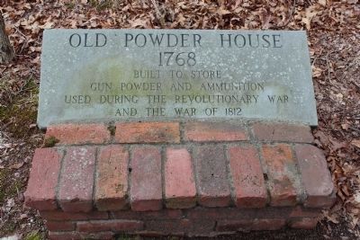
Photographed by Bryan Simmons, January 30, 2012
1. Old Powder House 1768 Marker
Topics. This historical marker is listed in these topic lists: Colonial Era • War of 1812 • War, US Revolutionary. A significant historical year for this entry is 1812.
Location. 41° 56.528′ N, 71° 20.335′ W. Marker is in North Attleborough, Massachusetts, in Bristol County. It is on Mount Hope Street, on the right when traveling west. Touch for map. Marker is at or near this postal address: 9 Mt Hope St, North Attleboro MA 02760, United States of America. Touch for directions.

Regionally, this marker is in Greater Providence. It is also in the American Northeast, in New England, and on the Eastern Seaboard. Globally, it is in the North Atlantic Region, North America, the Western Hemisphere, the Western World, and the Anglosphere. Historically, it finds itself in what was once one of the original Thirteen Colonies.
Other nearby markers. At least 8 other markers are within 3 miles of this marker, measured as the crow flies: Draper Farm Historic Site (approx. 0.7 miles away); Garland - Muccio Square (approx.
this page online
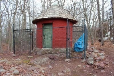
Photographed by Bryan Simmons, January 30, 2012
2. Old Powder House
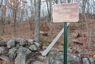
Photographed by Bryan Simmons, January 30, 2012
3. Old Powder House 1768 Marker
Credits. This page was last revised on September 13, 2021. It was originally submitted on May 26, 2012, by Bryan Simmons of Attleboro, Massachusetts. This page has been viewed 2,479 times since then and 148 times this year. Photos: 1, 2, 3. submitted on May 26, 2012, by Bryan Simmons of Attleboro, Massachusetts. • Bill Pfingsten was the editor who published this page.
