Sunderland in Calvert County, Maryland — The American Northeast (Mid-Atlantic)
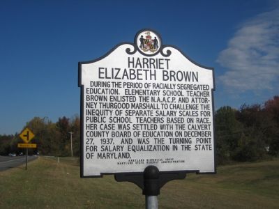
Harriet Elizabeth Brown
Erected by Maryland Historical Trust, Maryland State Highway Administration.
Topics and series. This historical marker is listed in these topic lists: African Americans • Civil Rights • Education • Women. In addition, it is included in the Maryland Historical Trust series list. A significant historical date for this entry is December 27, 1937.
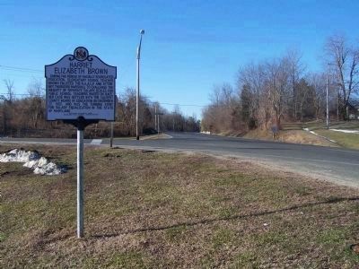
Location. 38° 40.434′ N, 76° 35.786′ W. Marker is in Sunderland, Maryland, in Calvert County. Marker is at the intersection of Solomons Island Road (Maryland Route 2) and Pushaw Station Road, on the right when traveling north on Solomons Island Road. Touch for map. Marker is at or near this postal address: 35 Pushaw Station Road, Sunderland MD 20689, United States of America. Touch for directions.
Other nearby markers. At least 8 other markers are within 3 miles of this marker, measured as the crow flies. The First All Saints Church (approx. 0.9 miles away); All Saints Episcopal Church (approx. one mile away); Calvert County (approx. 2.7 miles away); A County in Ruin (approx. 2.7 miles away); Railroad Bed (approx. 2.7 miles away); Forest Edges (approx. 3 miles away); Watershed (approx. 3 miles away); Tree Canopy (approx. 3 miles away). Touch for a list and map of all markers in Sunderland.
Credits. This page was last revised on August 17, 2019. It was originally submitted on November 11, 2007, by F. Robby of Baltimore, Maryland. This page has been viewed 2,765 times since then and 42 times this year. Last updated on February 21, 2008, by Christopher Busta-Peck of Shaker Heights, Ohio. Photos: 1. submitted on November 11, 2007, by F. Robby of Baltimore, Maryland. 2. submitted on March 7, 2010, by Mike Stroud of Bluffton, South Carolina. 3. submitted on November 11, 2007, by F. Robby of Baltimore, Maryland. • Kevin W. was the editor who published this page.


