Near Bedford in Bedford County, Virginia — The American South (Mid-Atlantic)
Peaks of Otter
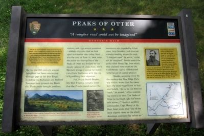
ďA rougher road could not be imaginedĒ
ó Hunterís Raid ó
On May 26, 1864, Union Gen. David Hunter marched south from Cedar Creek near Winchester to drive out Confederate forces, lay waste to the Shenandoah Valley, and destroy transportation facilities at Lynchburg. His raid was part of Gen. Ulysses S. Grantís strategy to attack Confederates simultaneously throughout Virginia. After defeating Gen. William E. “Grumble” Jones at Piedmont on June 5, Hunter marched to Lexington, burned Virginia Military Institute, and headed to Lynchburg. There, on June 17-18, Gen. Jubal A. Early repulsed Hunter and pursued him to West Virginia. Early then turned north in July to threaten Washington.
(marker text)
By the mid-19th century, several turnpikes had been constructed through gaps in the Blue Ridge, including the Buchanan and Bedford Turnpike here (present-day Route 43). These roads brought peddlers, visitors, and – on several occasions – soldiers to places that we look upon as vacation sites today. Such was the case on June 15, 1864, When the peace and tranquility of the Peaks of Otter was broken by the steady cadence of Union Gen. David Hunterís troops crossing the mountains from Buchanan with the city of Lynchburg their objective.
Pvt. Frank Smith Reader, 5th West Virginia Cavalry, noted that the 17-mile march across the mountains was impeded by felled trees, large boulders, and diverted streams washing across the road. “A rougher road,” he wrote, “could not be imagined.” Scouts scaled the peak called Sharp Top, from which, they claimed, they could see the Confederate capital of Richmond with the aid of a good spyglass.
Reader, sounding every bit the modern-day Blue Ridge Parkway visitor, wrote that the views were the most magnificent he had ever beheld. “As far as the eyes can reach,” he mused, “a fine undulating country is seen. The Peaks of Otter is the finest sight for mountain scenery.” Hunterís artillery commander, Capt. Henry A. du Pont, later wrote that “one of the most superb views on the whole American continent lay before us.”
(sidebar)
David Hunter Strother, artist and illustrator, was born in Martinsburg, Va. (now W.Va.) on Sept. 16, 1816. He studied art in Philadelphia and New York then toured the American West and Europe. Under the pen name Porte Crayon, he gained fame in the 1850s for his illustrations for Harperís Magazine and his books, including Virginia Illustrated. He served in the U.S. Army as an officer during the Civil War and as consul-general to Mexico (1779-1885). He died in Charleston, W.Va., on Mar. 8, 1888.
Erected by Virginia Civil War Trails.
Topics and series. This historical marker is listed in this topic list: War, US Civil. In addition, it is included in the Blue Ridge Parkway, and the Virginia Civil War Trails series lists. A significant historical month for this entry is May 1861.
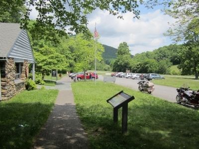
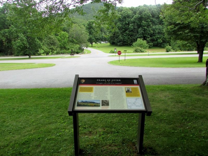
Location. 37° 26.728′ N, 79° 36.604′ W. Marker is near Bedford, Virginia, in Bedford County. Marker is on Blue Ridge Parkway near Peaks Road (Virginia Route 43). Located in front of the NPS Peaks of Otter Visitor Center. Touch for map. Marker is at or near this postal address: 85919 Blue Ridge Parkway, Bedford VA 24523, United States of America. Touch for directions.
Other nearby markers. At least 8 other markers are within 7 miles of this marker, measured as the crow flies. A Community at "the Mons" (within shouting distance of this marker); Abbott Lake (approx. 0.3 miles away); Polly Woods' Ordinary (approx. half a mile away); a different marker also named Peaks of Otter (approx. 4.9 miles away); 1889 Thaxton Train Wreck (approx. 6.6 miles away); The Anchorage (approx. 6.8 miles away); Buchanan (approx. 6.8 miles away); The Botetourt Artillery (approx. 6.8 miles away). Touch for a list and map of all markers in Bedford.
More about this marker. On the lower left is a painting with the caption, “The Peaks of Otter and the Town of Liberty” (now Bedford City) was painted in 1855 by Ed Beyer.
— Courtesy of the Virginia Historical Societyís Lora Robins Collection, partial gift of Mildred E. Lang
In the center is a sketch with the caption, “In the Gap of the Peaks of Otter,” by David Hunter Strother
On the upper right is a photograph of David Hunter Strother and on the lower right is a Virginia Civil War Trails map of Hunter's Raid.
Credits. This page was last revised on July 18, 2016. It was originally submitted on May 29, 2012, by Bernard Fisher of Richmond, Virginia. This page has been viewed 1,160 times since then and 31 times this year. Photos: 1, 2. submitted on May 29, 2012, by Bernard Fisher of Richmond, Virginia. 3. submitted on July 15, 2016, by Bill Coughlin of Woodland Park, New Jersey.


