Forest in Bedford County, Virginia — The American South (Mid-Atlantic)
New London Academy
Confederate Cavalry Line
| — | Hunter’s Raid | — |
Photographed by Bernard Fisher, May 28, 2012
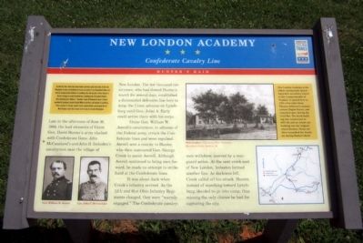
1. New London Academy CWT Marker
On May 26, 1864, Union Gen. David Hunter marched south from Cedar Creek near Winchester to drive out Confederate forces, lay waste to the Shenandoah Valley, and destroy transportation facilities at Lynchburg. His raid was part of Gen. Ulysses S. Grant’s strategy to attack Confederates simultaneously throughout Virginia. After defeating Gen. William E. “Grumble” Jones at Piedmont on June 5, Hunter marched to Lexington, burned Virginia Military Institute, and headed to Lynchburg. There, on June 17-18, Gen. Jubal A. Early repulsed Hunter and pursued him to West Virginia. Early then turned north in July to threaten Washington.
(marker text)
Late in the afternoon of June 16, 1864, the lead elements of Union Gen. David Hunter’s army clashed with Confederate Gens. John McCausland’s and John D. Imboden’s cavalrymen near the village of New London. The few thousand cavalrymen, who had slowed Hunter’s march for several days, established a dismounted defensive line here to delay the Union advance on Lynchburg until Gen. Jubal A. Early could arrive there with his corps.
Union Gen. William W. Averell’s cavalrymen,
this page online
It was about dark when Crook’s infantry arrived. As the 12th and 91st Ohio Infantry Regiments charged, they were “warmly engaged.” The Confederate cavalrymen withdrew, covered by a rearguard action. At the next creek east of New London, Imboden formed another line. As darkness fell, Crook called off his attack. Hunter, instead of marching toward Lynchburg, decided to go into camp, thus missing the only chance he had for capturing the city.
(sidebar)
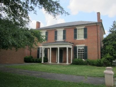
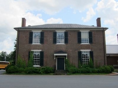
New London Academy is the oldest continuously operating public secondary school in the Commonwealth of Virginia. It opened here in 1795, a few miles from Thomas Jefferson’s summer retreat, Poplar Forest, and remained open during the Civil War. The brick building was constructed 1837-39, and an extant out-building was the original school kitchen. Union soldiers ransacked the Academy during Hunter’s
Photographed by Bernard Fisher, May 28, 2012
2. New London Academy CWT Marker
Erected by Virginia Civil War Trails.
Topics and series. This historical marker is listed in these topic lists: Education • War, US Civil. In addition, it is included in the Virginia Civil War Trails series list. A significant historical date for this entry is May 26, 1864.
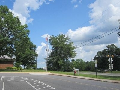
Location. 37° 18.372′ N, 79° 18.383′ W. Marker is in Forest, Virginia, in Bedford County. It is at the intersection of East Lynchburg Salem Turnpike (U.S. 460) and Thomas Jefferson Road (Virginia Route 811), on the right when traveling west on East Lynchburg Salem Turnpike. Located in the parking lot of New London Academy Elementary. Touch for map. Marker is at or near this postal address: 12400 East Lynchburg Salem Turnpike, Forest VA 24551, United States of America. Touch for directions.

Regionally, this marker is in Southwest Virginia. It is also in the American South and specifically in the Upper South. Globally, it is in North America, the Western Hemisphere, the Western World, and the Anglosphere. Historically, it finds itself in what was once the territory of the Mississippian Culture, one of the original Thirteen Colonies, one of
Photographed by Bernard Fisher, May 28, 2012
3. New London Academy (front)
Other nearby markers. At least 8 other markers are within 4 miles of this marker, measured as the crow flies: A different marker also named New London Academy (within shouting distance of this marker); Callaway-Steptoe Cemetery (approx. 0.7 miles away); Bedford County / Campbell County (approx. 0.9 miles away); New London (approx. 1½ miles away); Crafting a Masterpiece, Longing for Home (approx. 3.6 miles away); “I have this summer built a wing of offices...” (approx. 3.7 miles away); Mounds Made of Ideas and Sweat (approx. 3.7 miles away); Transforming a Plantation into a Private Retreat, 1806—1826 (approx. 3.7 miles away). Touch for a list and map of all markers in Forest.
Other markers no longer nearby. What happened to Poplar Forest after Jefferson's death? (was approx. 3.7 miles away but has been replaced with another marker now near it); Why is the lawn sunken? (was approx. 3.7 miles away but has been replaced with another marker now near it); Why build the mounds? (was approx. 3.7 miles away but has been replaced with another marker now near it).
More about this marker.
Photographed by Bernard Fisher, May 28, 2012
4. New London Academy (rear)
On the upper right is a sketch with the caption, "New London — Courtesy of Peter Viemeister, Hamilton’s Books, Bedford, VA"
On the lower right is a Virginia Civil War Trails map of Hunter's Raid
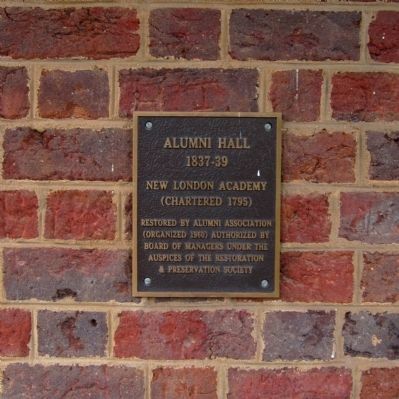
Photographed by Bernard Fisher, May 28, 2012
5. Alumni Hall (New London Academy)
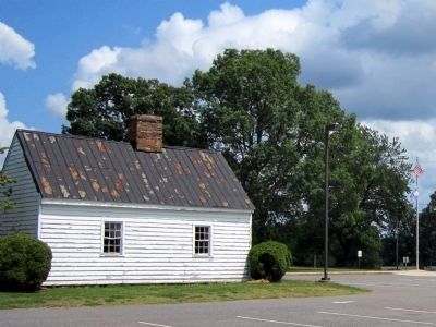
Photographed by Bernard Fisher, May 28, 2012
6. New London Academy kitchen
Credits. This page was last revised on June 16, 2016. It was originally submitted on May 29, 2012, by Bernard Fisher of Richmond, Virginia. This page has been viewed 1,484 times since then and 82 times this year. Photos: 1, 2, 3, 4, 5, 6. submitted on May 29, 2012, by Bernard Fisher of Richmond, Virginia.
