Near Sharpsburg in Washington County, Maryland — The American Northeast (Mid-Atlantic)
September 17, 1862 (Continued)
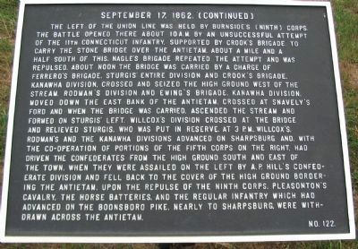
Photographed by Craig Swain, August 5, 2007
1. September 17, 1862 (Continued) Marker
this page online
Erected by Antietam Battlefield Board. (Marker Number 122.)
Topics and series. This historical marker is listed in this topic list: War, US Civil. In addition, it is included in the Antietam Campaign War Department Markers series list.
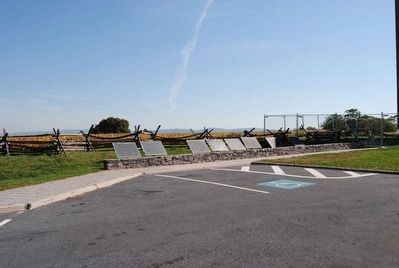
Location. 39° 28.174′ N, 77° 44.176′ W. Marker is near Sharpsburg, Maryland, in Washington County. It is on Richardson Avenue, on the left when traveling east. Located at a tablet cluster near the Sunken Road next to the observation tower, stop eight on the driving tour of Antietam. Touch for map. Marker is in this post office area: Sharpsburg MD 21782, United States of America. Touch for directions.

Regionally, this marker is in Western Maryland. It is also in the American Mid-Atlantic, in Appalachia, and specifically in Northern Appalachia. Globally, it is in North America, the Western Hemisphere,
Photographed by Bill Coughlin, April 13, 2011
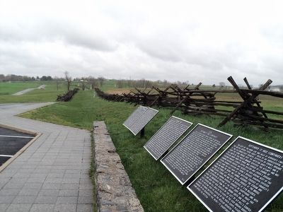
2. September 17, 1862 Markers
The three September 17, 1862 markers are seen here (3 rightmost tablets). The Bloody Lane is also visible in the background.
Other nearby markers. At least 8 other markers are within walking distance of this marker: Army of Northern Virginia (here, next to this marker); a different marker also named September 17, 1862 (Continued) (here, next to this marker); a different marker also named Army of Northern Virginia (here, next to this marker); September 17, 1862 (here, next to this marker); a different marker also named Army of Northern Virginia (here, next to this marker); September 16, 1862 (here, next to this marker); Army of the Potomac (a few steps from this marker); Hexamer's (New Jersey) Battery (a few steps from this marker). Touch for a list and map of all markers in Sharpsburg.
More about this marker. One of five tablets erected at this location to describe the activities of the Army of the Potomac from September 15-17, 1862.
Also see . . .
1. Antietam Battlefield. National Park Service site. (Submitted on February 21, 2008, by Craig Swain of Leesburg, Virginia.)
2. Burnside's Corps Attacks the Lower Bridge.
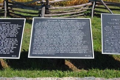
Photographed by Brian Scott, September 19, 2015
3. September 17, 1862 (Continued) Marker
3. Rodman's Division Crosses at Snavely's Ford. Battle map from "Antietam on the Web" showing the tenth phase of the battle. (Submitted on February 21, 2008, by Craig Swain of Leesburg, Virginia.)
4. Burnside's Corps Advances on Sharpsburg. Battle map from "Antietam on the Web" showing the eleventh phase of the battle. (Submitted on February 21, 2008, by Craig Swain of Leesburg, Virginia.)
5. A.P. Hill's Division Attacks Burnside's Flank. Battle map from "Antietam on the Web" showing the twelfth and final phase of the battle. (Submitted on February 21, 2008, by Craig Swain of Leesburg, Virginia.)
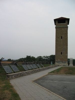
Photographed by Craig Swain
4. Tablet Cluster next to the Observation Tower
Photographed by Brian Scott, September 19, 2015
5. September 17, 1862 (Continued) Marker
Second From the Right
Second From the Right
Credits. This page was last revised on April 2, 2022. It was originally submitted on February 21, 2008, by Craig Swain of Leesburg, Virginia. This page has been viewed 1,013 times since then and 27 times this year. Photos: 1. submitted on February 21, 2008, by Craig Swain of Leesburg, Virginia. 2. submitted on April 16, 2011, by Bill Coughlin of Woodland Park, New Jersey. 3. submitted on September 27, 2015, by Brian Scott of Anderson, South Carolina. 4. submitted on February 20, 2008, by Craig Swain of Leesburg, Virginia. 5. submitted on September 27, 2015, by Brian Scott of Anderson, South Carolina.
