Alta in Greenbrier County, West Virginia — The American South (Appalachia)
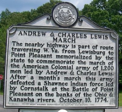
Andrew & Charles Lewis March
Erected 1982 by West Virginia Department of Culture and History.
Topics and series. This historical marker is listed in this topic list: War, French and Indian. In addition, it is included in the West Virginia Archives and History series list. A significant historical date for this entry is October 10, 1774.
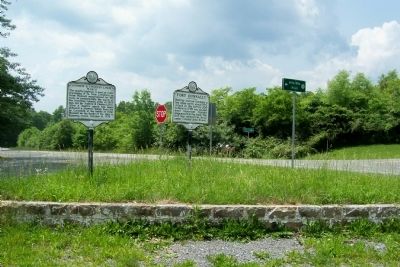
Location. 37° 52.156′ N, 80° 32.586′ W. Marker is in Alta, West Virginia, in Greenbrier County. Marker is at the intersection of Midland Trail West (U.S. 60) and Alta Mountain Road (Old West Virginia Route 12) on Midland Trail West. Touch for map. Marker is at or near this postal address: 45 Midland Trail West, Crawley WV 24931, United States of America. Touch for directions.
Other nearby markers. At least 8 other markers are within 6 miles of this marker, measured as the crow flies. Maxon Sand (approx. 1.6 miles away); Fort Donnally / Border Heroes (approx. 2.2 miles away); Unknown Soldiers/ Gen. Lewis' Trace (approx. 3.9 miles away); Battle of Tuckwiller's Hill (approx. 5 miles away); Confederate Disenfranchisement (approx. 5 miles away); Sam Black Church (approx. 5.2 miles away); Greenbrier Ghost (approx. 5.4 miles away); The Pavilion (approx. 5.9 miles away). Touch for a list and map of all markers in Alta.
Credits. This page was last revised on December 26, 2023. It was originally submitted on May 30, 2012, by Forest McDermott of Masontown, Pennsylvania. This page has been viewed 1,106 times since then and 34 times this year. Last updated on December 25, 2023, by Carl Gordon Moore Jr. of North East, Maryland. Photos: 1, 2. submitted on May 30, 2012, by Forest McDermott of Masontown, Pennsylvania. • Devry Becker Jones was the editor who published this page.

