Rehoboth in Bristol County, Massachusetts — The American Northeast (New England)
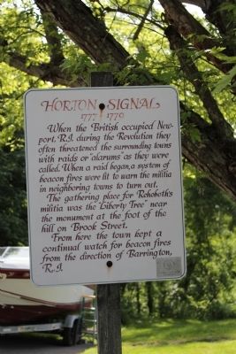
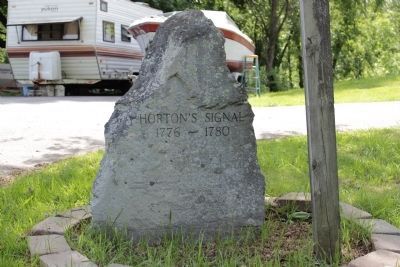
Horton Signal
1777 - 1779
The gathering place for Rehoboth's militia was the "Liberty Tree" near the monument at the foot of the hill on Brook Street.
From here the town kept a continual watch for beacon fires from the direction of Barrington R.I.
Erected by Rehoboth Historical Commission.
Topics. This historical marker is listed in these topic lists: Colonial Era • Settlements & Settlers • War, US Revolutionary.
Location. 41° 48.484′ N, 71° 14.778′ W. Marker is in Rehoboth, Massachusetts, in Bristol County. Marker is on Chestnut Street north of Brook Street, on the right when traveling north. Touch for map. Marker is at or near this postal address: 243 Chestnut Street, Rehoboth MA 02769, United States of America. Touch for directions.
Other nearby markers. At least 8 other markers are within 2 miles of this marker, measured as the crow flies. Site of Original Oak Swamp Church (approx. 0.3 miles away); Samual Baker Grist & Sawmill Site (approx. 0.4 miles away); Liberty Tree (approx. 0.4 miles away); Palmer River Pound (approx. 0.6 miles away); Daniel Bullock- Samuel Baker Sawmill site 1750-1850 (approx. 0.9 miles away); Orleans Manufacturing Co. (approx. 1.6 miles away); The Palmer's River Meeting House (approx. 1.7 miles away); Bad Luck Pond (approx. 2 miles away). Touch for a list and map of all markers in Rehoboth.
Credits. This page was last revised on June 16, 2016. It was originally submitted on June 2, 2012, by Bryan Simmons of Attleboro, Massachusetts. This page has been viewed 837 times since then and 22 times this year. Photos: 1, 2, 3. submitted on June 2, 2012, by Bryan Simmons of Attleboro, Massachusetts. • Syd Whittle was the editor who published this page.


