Bainbridge in Decatur County, Georgia — The American South (South Atlantic)
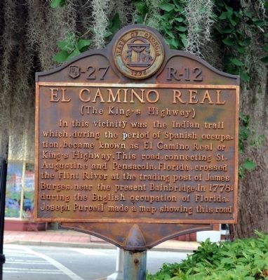
El Camino Real
(The King’s Highway)
Erected by Works Progress Administration. (Marker Number 27 R-12.)
Topics and series. This historical marker is listed in these topic lists: Exploration • Native Americans • Roads & Vehicles. In addition, it is included in the Georgia Historical Society, and the Works Progress Administration (WPA) projects series lists. A significant historical year for this entry is 1778.
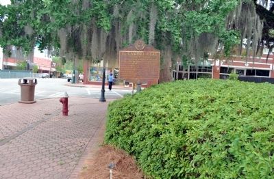
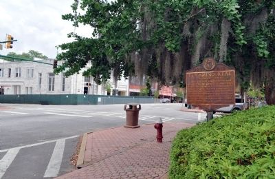
Location. 30° 54.364′ N, 84° 34.547′ W. Marker is in Bainbridge, Georgia, in Decatur County. Marker is at the intersection of North Broad Street (Business U.S. 27) and East Broughton Street, on the left when traveling north on North Broad Street. The marker stands at the southeast corner of Willis Park. Touch for map. Marker is in this post office area: Bainbridge GA 39817, United States of America. Touch for directions.
Other nearby markers. At least 8 other markers are within walking distance of this marker. The Bainbridge Volunteers (within shouting distance of this marker); In Memory of Revolutionary Soldiers (within shouting distance of this marker); De Soto Trail (within shouting distance of this marker); Decatur County (about 300 feet away, measured in a direct line); First Presbyterian Church (about 400 feet away); Camp Recovery (approx. 0.2 miles away); First United Methodist Church (approx. 0.2 miles away); The J.D. Chason Memorial Park / The J.D. Chason Memorial Park History (approx. 0.2 miles away). Touch for a list and map of all markers in Bainbridge.
More about this marker. Works Progress Administration markers were generally erected in the late 1930s.
Credits. This page was last revised on June 16, 2016. It was originally submitted on June 2, 2012, by David Seibert of Sandy Springs, Georgia. This page has been viewed 976 times since then and 32 times this year. Photos: 1, 2, 3. submitted on June 2, 2012, by David Seibert of Sandy Springs, Georgia. • Craig Swain was the editor who published this page.


