Faceville in Decatur County, Georgia — The American South (South Atlantic)
Ira Sanborn
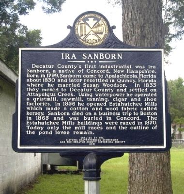
Photographed by David Seibert, February 28, 2005
1. Ira Sanborn Marker
Erected 2001 by Historic Chattahoochee Commission and the Decatur County Historical Society.
Topics. This historical marker is listed in these topic lists: Cemeteries & Burial Sites • Industry & Commerce • Settlements & Settlers. A significant historical year for this entry is 1799.
Location. 30° 45.19′ N, 84° 38.491′ W. Marker is in Faceville, Georgia, in Decatur County. It is at the intersection of Faceville Highway (Georgia Route 97) and Florida Street,
this page online

Regionally, this marker is on Georgia’s Coastal Plain. It is also in the American South and specifically in the Deep South. Globally, it is in North America, the Western Hemisphere, the Western World, and the Anglosphere. Historically, it finds itself in what was once the territory of the Mississippian Culture, one of the original Thirteen Colonies, one of the Confederate States of America, and the Antebellum South.
Other nearby markers. At least 8 other markers are within 10 miles of this marker, measured as the crow flies: Charles James Munnerlyn / “Refuge” (approx. 3.1 miles away); Village of Fowltown (approx. 3.1 miles away); Camp Recovery (approx. 5.4 miles away); Camp Recovery Monument (approx. 5.4 miles away); Fort Scott (approx. 5.6 miles away); Joshua Davis House (approx. 6½ miles away in Florida); Old Philadelphia Presbyterian Church (approx.
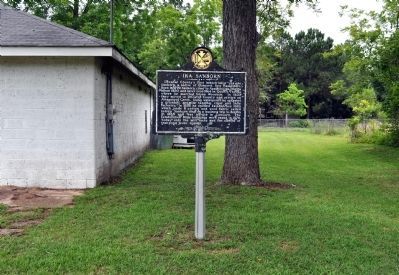
Photographed by David Seibert, May 16, 2012
2. Ira Sanborn Marker
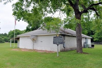
Photographed by David Seibert, May 16, 2012
3. Ira Sanborn Marker and the Faceville Masonic Lodge
Credits. This page was last revised on November 16, 2019. It was originally submitted on October 7, 2009, by David Seibert of Sandy Springs, Georgia. This page has been viewed 1,412 times since then and 34 times this year. Last updated on June 2, 2012, by David Seibert of Sandy Springs, Georgia. Photos: 1. submitted on October 7, 2009, by David Seibert of Sandy Springs, Georgia. 2, 3. submitted on June 2, 2012, by David Seibert of Sandy Springs, Georgia. • Craig Swain was the editor who published this page.
